
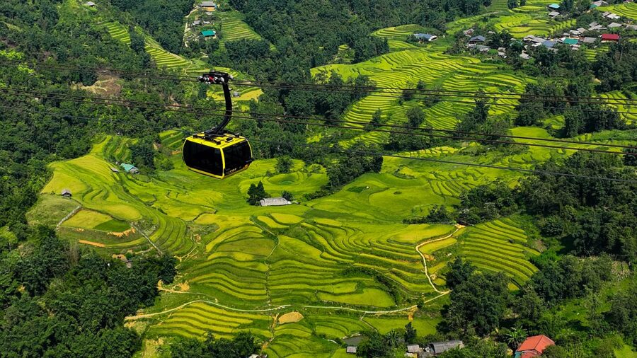
Fifteen minutes in a cable car will put you just below the summit of Fansipan, the highest point in Vietnam. The walk from Sapa down to Ta Van takes a whole morning, and it is the morning most people remember.
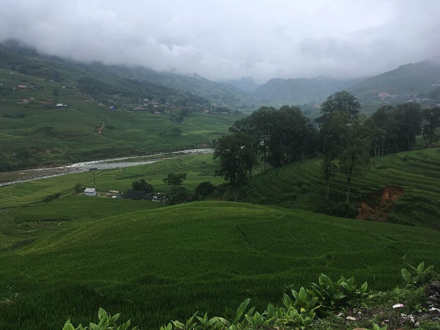
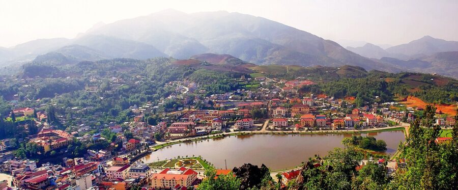
Sapa is a small hill town in the far north-west, strung along a ridge at about 1,500 metres above the Muong Hoa Valley and around 35 kilometres by road from the Chinese border at Lao Cai. The town itself is now mostly hotels. What brings people here lies below it: rice terraces cut into every slope, Hmong, Dao and Giay villages along the river, and the Hoang Lien range standing over all of it.
Give it three days if you can. Spend one on the mountain and the town, one or two walking in the valleys, and keep a spare for the weather, which in Sapa is never a formality.

Contents
- Where Sapa is, and what it is called now
- Getting there from Hanoi
- The town, as it is now
- Trekking: the valleys and the villages
- Fansipan, by cable car or on foot
- O Quy Ho pass and the waterfalls
- When to go: terraces, cold, fog and snow
- Where to stay: town or valley
- What to eat
- Bac Ha and a Sunday market
- How many days, and how Sapa fits a trip
Where Sapa is, and what it is called now
Sapa sits in the Hoang Lien Son range, a little over 300 kilometres by road north-west of Hanoi. The French arrived early in the twentieth century: a military post in 1903, a sanatorium and the first hotel in 1909, and villas through the 1920s and 1930s for officials escaping the summer heat of the Delta. Much of that was destroyed in the war of the late 1940s and again in the 1979 border war with China. The town you see today is largely a rebuild from the 1990s on.
Its address changed in 2025. On 1 July that year Vietnam abolished its district tier of government and merged provinces, and the old Yen Bai province was folded into Lao Cai. Sa Pa stopped being a town (thị xã) and became a ward: the six former urban wards of Ham Rong, O Quy Ho, Sa Pả, Cau May, Phan Si Pang and Sa Pa were merged into one phường Sa Pa of about 55 square kilometres and 23,000 people.
The valleys were reorganised too. Lao Chai, Ta Van and Cat Cat now all sit inside a larger Ta Van commune (xã Tả Van), formed from the old Hoang Lien, Muong Hoa and Ta Van communes. Ta Phin, Ban Ho, Ngu Chi Son and Muong Bo are communes of their own.
For you this matters on paper only. A homestay listed as “Lao Chai, Sa Pa district” and one listed as “xã Tả Van, tỉnh Lào Cai” can be the same house, and booking pages, maps and signs are catching up at different speeds. Search by the property’s name and village, check the map pin rather than the commune, and do not worry if a ticket or receipt uses the old name while your booking uses the new one.

Getting there from Hanoi
Nothing flies to Sapa. An airport has been planned for years at Cam Con in Bao Yen, a long way south of the town, with a target of opening before 2030, and the site has barely moved since its ground-breaking in 2022. So it is the road, or the railway as far as Lao Cai and then the road.
By bus or limousine van
The road is the faster way up. The Noi Bai to Lao Cai expressway carries you most of the distance, and since September 2023 a 13.8-kilometre toll road has climbed from the Lao Cai interchange to Sapa over the Mong Sen bridge, the tallest viaduct in Vietnam. Door to door, Hanoi to Sapa by road takes five and a half to six and a half hours.
Sleeper buses, with two tiers of semi-flat berths, leave through the day and late into the evening. Limousine vans carry fewer people in wider seats and are the better choice by day. Many operators collect from Old Quarter hotels.
Check the arrival time before you book a night bus. A six-hour run that leaves at ten in the evening reaches Sapa at four in the morning, long before any room is ready. Allow extra time through 2026 as well: the Yen Bai to Lao Cai section of the expressway has been under widening works since October 2025, with completion expected around Tet 2027.
By night train to Lao Cai
The train is slower, but you lie flat and wake up in the mountains. Sapa has no railway station. Trains run from Hanoi Station to Lao Cai, on the border, and you go up the mountain by road from there.
As of October 2026 Vietnam Railways runs three overnight trains each way, plus one daytime train back to Hanoi. A third pair, SP15 and SP16, was added on 10 October 2026.
| Train | Leaves | Arrives |
|---|---|---|
| SP15 | Hanoi 21:45 | Lao Cai 05:20 |
| SP3 | Hanoi 22:00 | Lao Cai 05:50 |
| SP7 | Hanoi 22:40 | Lao Cai 06:27 |
| SP16 | Lao Cai 21:25 | Hanoi 05:15 |
| SP4 | Lao Cai 21:50 | Hanoi 05:40 |
| SP8 (day) | Lao Cai 12:05 | Hanoi 19:30 |
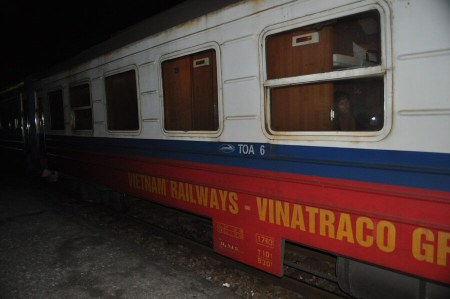

Fares change with the date and the berth; check them on the Vietnam Railways booking site (dsvn.vn) or at the station. Several private companies run their own refitted sleeper carriages coupled to these same trains, with better bedding at a higher price. The timetable is the same whichever carriage you are in.
I would take the train up and the road back. The night train hands you Sapa at breakfast with a full day ahead of you, and a daytime van down spares you a second broken night.

From Lao Cai up to Sapa
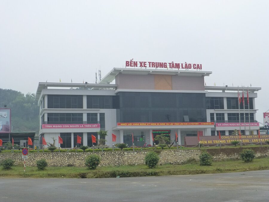
From Lao Cai station it is around 35 kilometres and about an hour to Sapa. Shared minibuses, taxis and hotel transfers wait outside for the morning trains, and a public bus is the cheapest way up. Agree the price before you get in, or book the transfer with your hotel: this forecourt at dawn is the first place on the trip where a tired arrival gets overcharged.
Going back, leave Sapa at least two hours before an evening train, because fog on the road down is common.

The town, as it is now
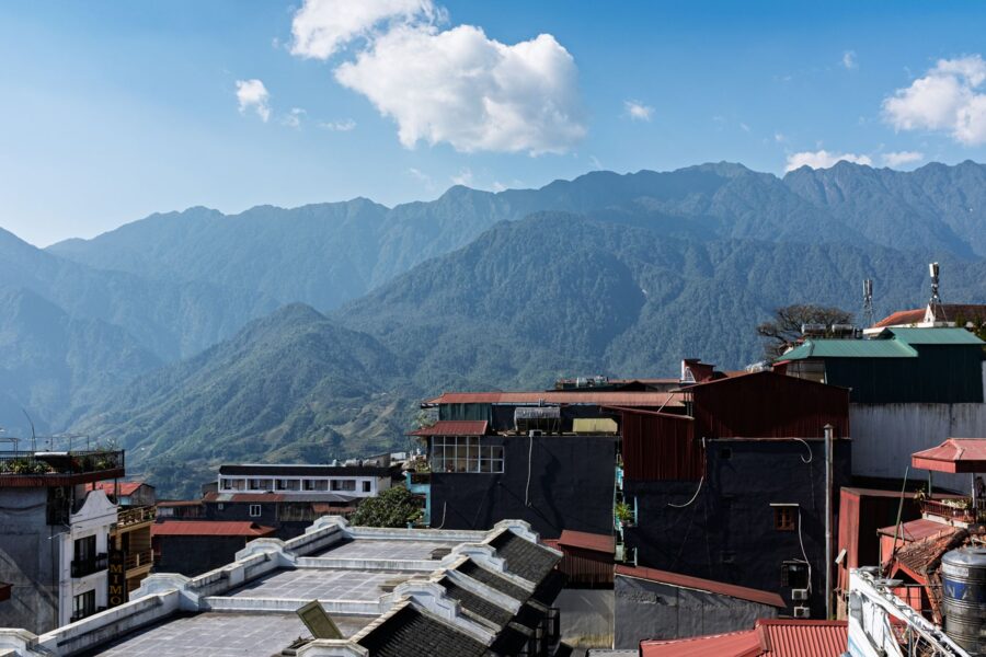
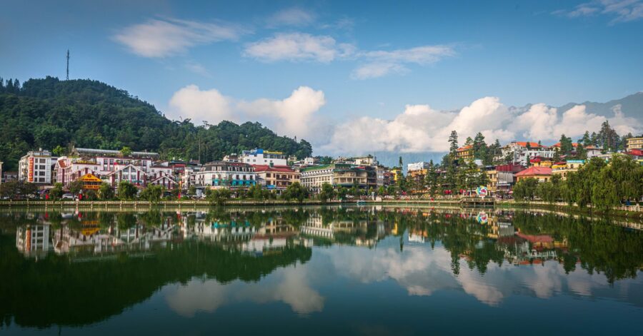
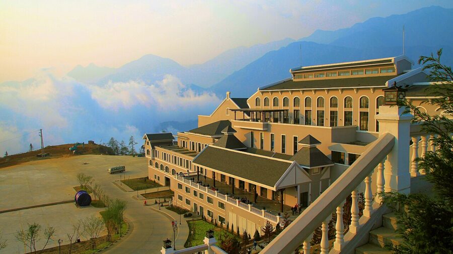
Be ready for the town. Sapa has grown fast, and its centre is a grid of tall hotels, coffee chains, massage parlours and souvenir shops, with new building going up most years. On a clear evening the lake and the church square are pleasant. In fog, which is often, it can feel like a ski resort out of season.
The stone church (Nhà thờ đá) on the main square is the town’s landmark from the French period. Sources give dates for it from the mid-1920s to 1934, and it is still a working parish church. On Saturday evenings the square hosts the “love market”, now a public evening of music and dancing for visitors more than the courtship gathering of Hmong and Dao young people it grew from.
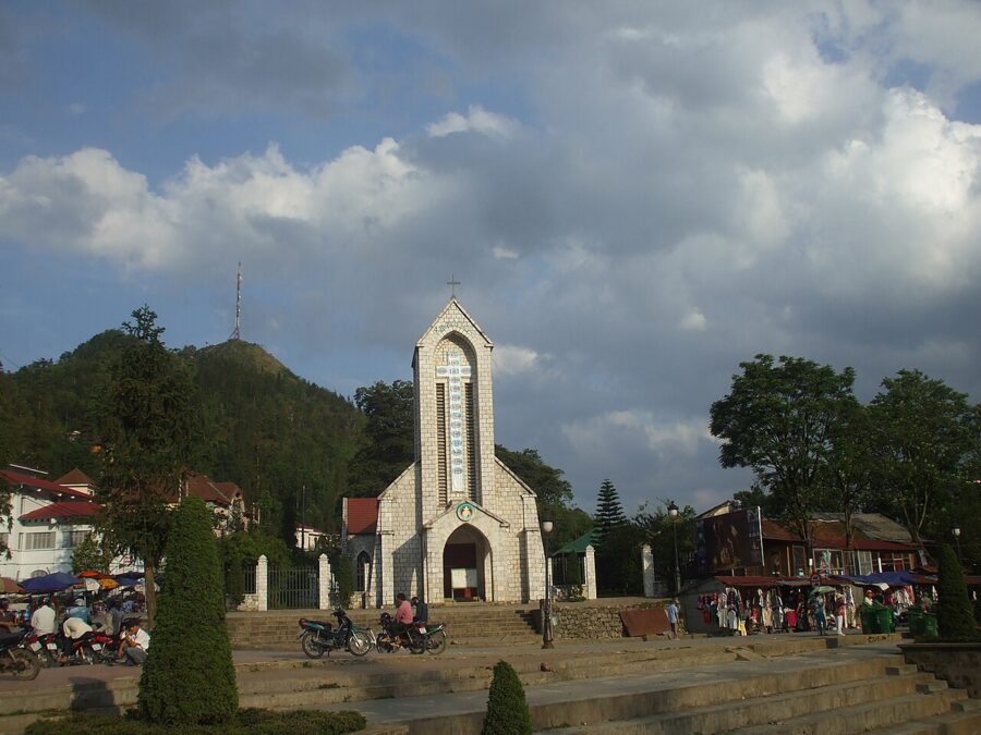

Ham Rong, the hill directly behind the church, is a planted park of orchid gardens and rock outcrops with viewpoints over the town and the valley. It is the easiest big view in Sapa. It is also the one ticket to skip on a fogged-in day, because the view is the whole point.

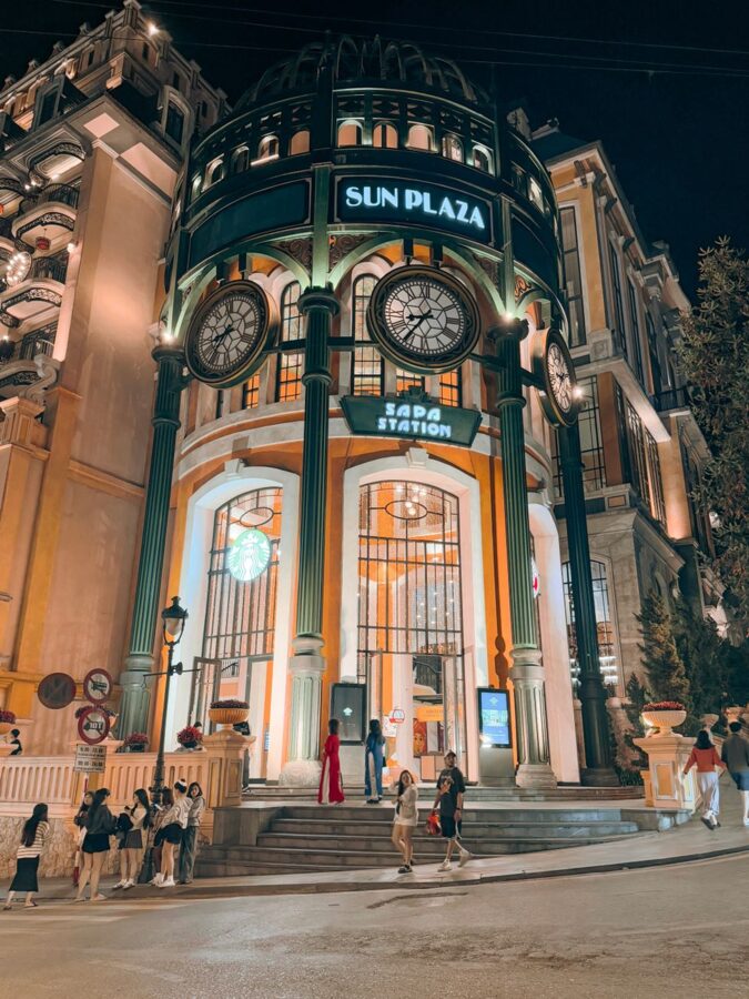
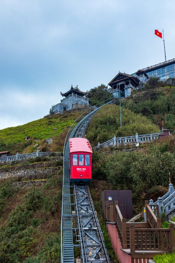
The newest landmark is Sun Plaza, the shopping centre on the main street, which is also the station for the Muong Hoa train down to the Fansipan cable car. The ride takes about six minutes and costs 100,000 dong (about $4) each way, as of March 2026.
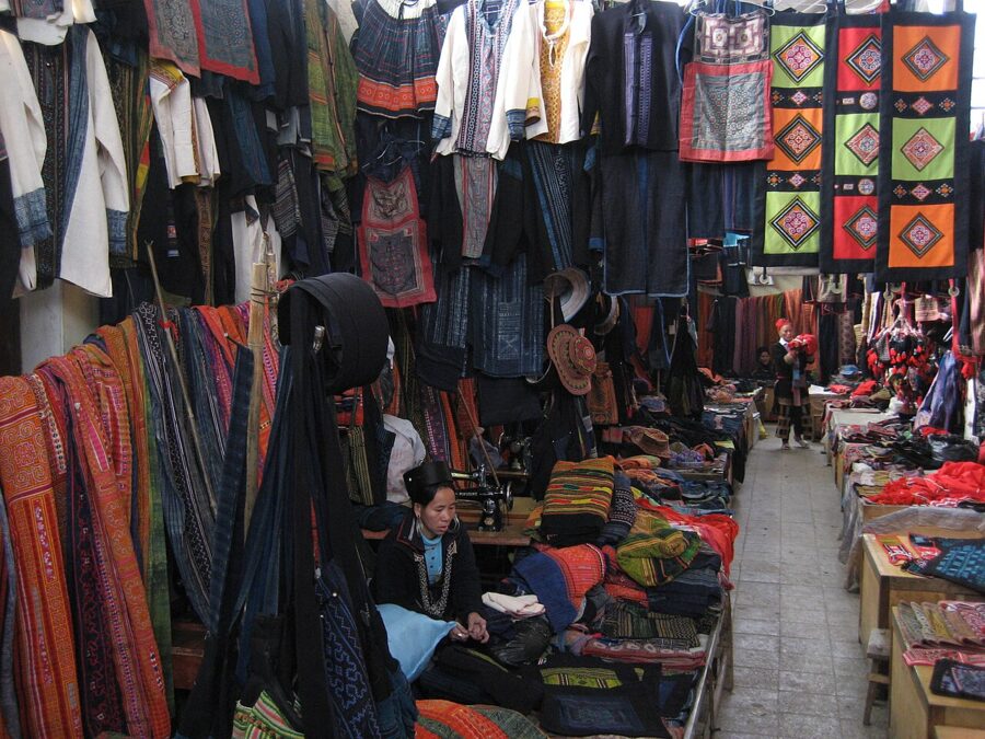
The small free museum at 2 Fansipan Street is worth an hour on your first afternoon: it explains who lives in which valley and how to tell the groups apart by dress. Sapa market and the stalls near the church sell indigo cloth, embroidered bags and silver; prices are set for visitors, and bargaining is normal.

Trekking: the valleys and the villages
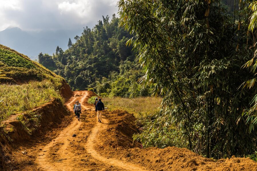
Walking is the point of Sapa, and you do not need to be a hiker. The routes follow farm paths, concrete village lanes and stretches of terrace wall, mostly downhill from the ridge to the river. What makes them hard is mud from May to September and the fog, which can turn a familiar path into a guess.
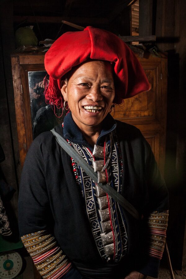
The valleys are home to several peoples. At the 2019 census the former Sa Pa town area, valleys included, was about half Hmong and almost a quarter Dao, with Kinh, Tay, Giay and smaller groups making up the rest. Black Hmong families farm Lao Chai and Cat Cat, Ta Van is largely Giay with Hmong neighbours, and the Red Dao live in Ta Phin and further down the Muong Hoa Valley.
Muong Hoa: Y Linh Ho, Lao Chai and Ta Van
The classic walk follows the Muong Hoa Valley south-east of town. Most people take the road towards Cau May, drop down to Y Linh Ho, follow the terraces to Lao Chai, then walk along the river to Ta Van, which is about 11 kilometres from the town centre by road. Depending on the line you take it is 7 to 12 kilometres and two to five hours, plus stops.
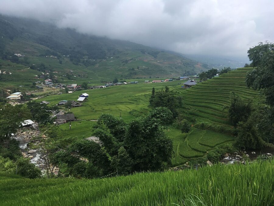

You can walk the Lao Chai to Ta Van stretch without a guide; the lane follows the river and is busy with other walkers. The descent from Y Linh Ho is where people get lost, because farm paths split at every terrace. In fog or after rain I would take a guide for that part.
There is a ticket checkpoint on the road into Lao Chai and Ta Van. Carry cash, and keep the ticket, which covers the walk through both villages.
Between the two villages the road passes the Sa Pa ancient rock field (bãi đá cổ), a scatter of boulders by the river cut with lines, spirals and figures. Some read them as maps of terraced fields; nobody has settled their age or their meaning. Most groups walk straight past, so ask your guide to stop.
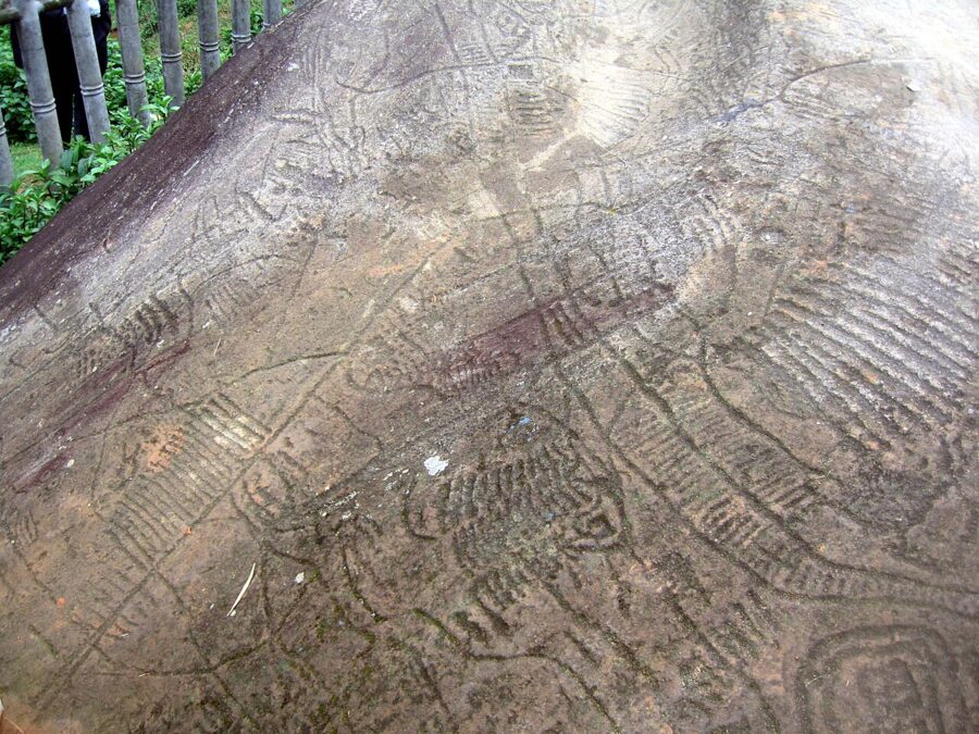

Ta Van is where most of the homestays are, and the village goes quiet after the day groups leave in the late afternoon. You do not have to climb back to town on foot: your homestay or a shop in the village can call a taxi or a motorbike taxi.
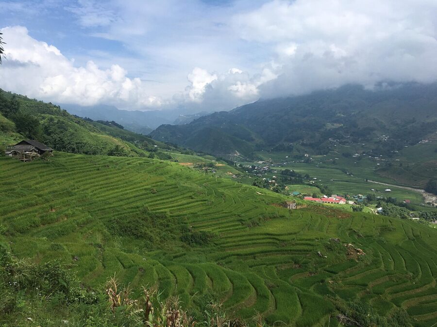

Keep going down the valley and it empties. Giang Ta Chai, a Red Dao village a couple of kilometres past Ta Van, has a waterfall and a suspension bridge, and the valley runs on towards Su Pan and Ban Ho, a Tay village by a river deep in the hills.
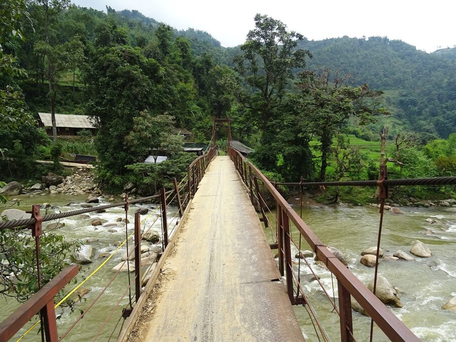

Cat Cat, the easy one
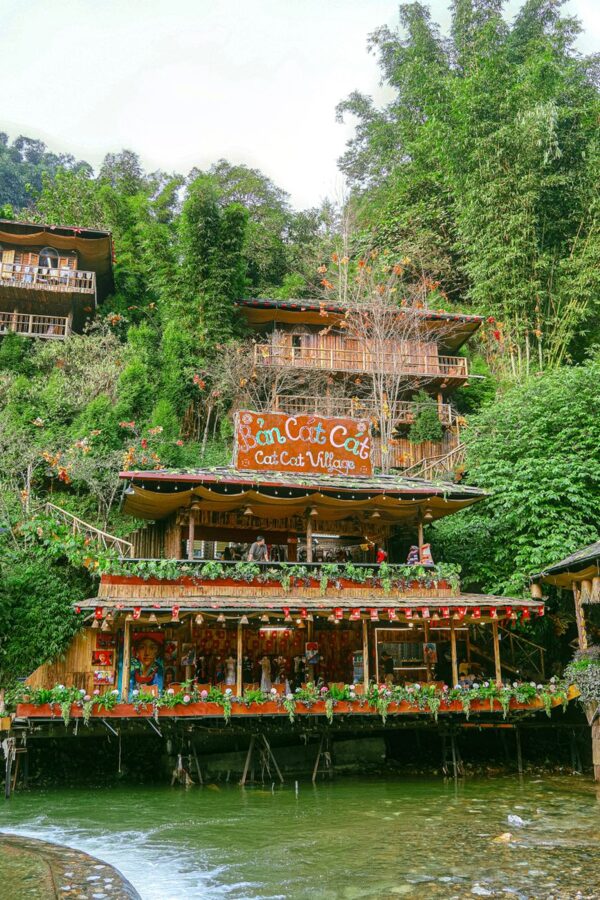
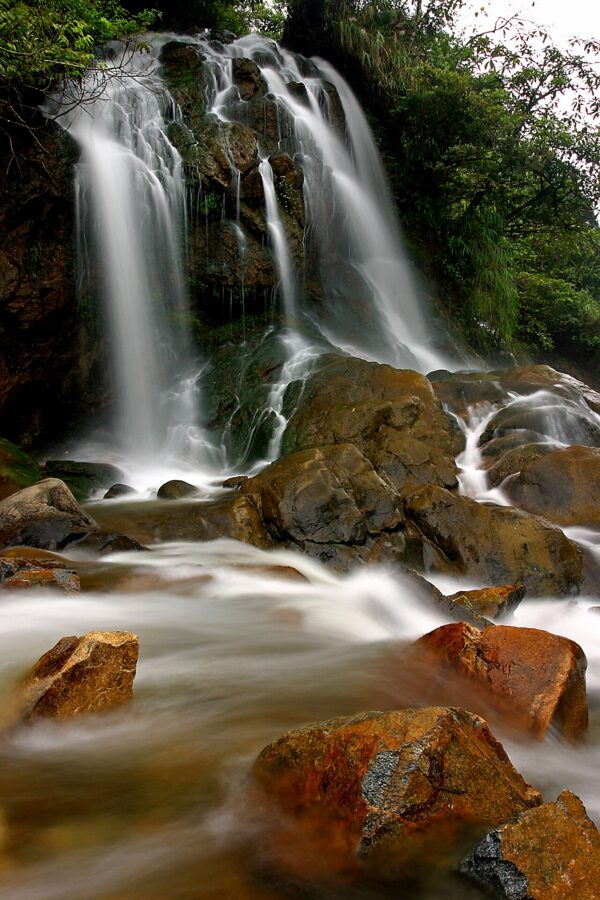
Cat Cat is the village you can walk to from the church in about half an hour, which is both its appeal and its problem. It is a Black Hmong village laid out as a ticketed visitor route, 150,000 dong (about $6) for adults as of 2026. Stone steps lead down past craft stalls, water wheels and cafes to a waterfall and the remains of a French-era hydroelectric station.
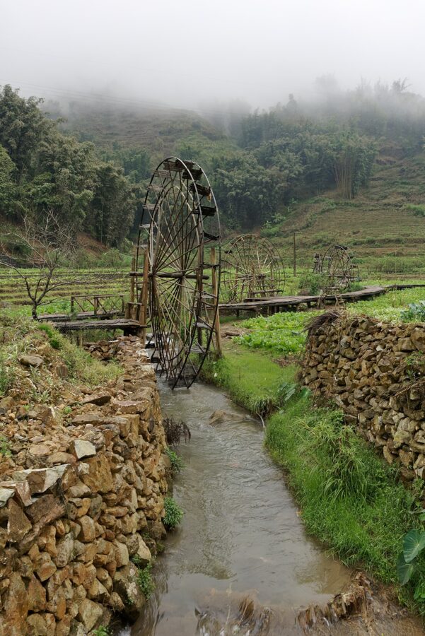

Much of what you see has been built for visitors, and it shows. Go at opening time, before the tour groups, and treat it as a pretty hour rather than a look at village life. Take a motorbike taxi back up: the steps down are easy and the climb out is not.

Ta Phin and the Red Dao
Ta Phin lies in a separate valley north-east of town, around 10 kilometres by road, and it is the main Red Dao village near Sapa. Women in red headcloths sell embroidery along the village street. The thing to do here is the Red Dao herbal bath, a wooden tub of hot water steeped with twenty or more forest herbs, and the best end to a day of walking I know of.
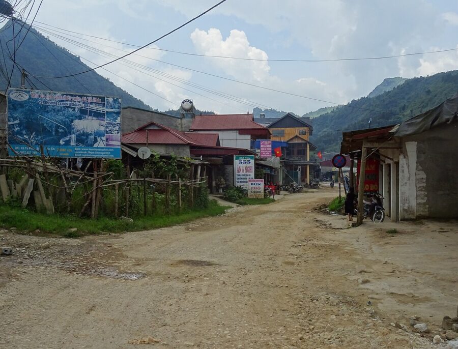

Eat lightly half an hour before a herbal bath, not on an empty stomach or a full one, and skip it if you have broken skin or eczema. On the way, the roofless stone walls of a 1940s Catholic convent stand in the fields below the road. There is a limestone cave above the village too; it is unlit, so bring a torch.

Longer and quieter routes
If Lao Chai feels busy, the walks people come back for are further out. Hau Thao climbs above the opposite bank of the Muong Hoa River, Sin Chai sits under the Fansipan ridge north-west of town, and the long valley down to Ban Ho works as a two-day walk with a homestay night. These need a guide: paths are not marked, they change with each planting season, and the villages see far fewer outsiders.
Guides, tickets and manners
Local guides, many of them Hmong and Dao women from the valley villages, are the best value in Sapa. They know which path is passable after rain, and the money stays in the valley. Book through your homestay or a guide you can meet first, and agree the route, the price and whether lunch is included before you set off.
A fair day trek includes a guide who speaks enough English to talk about the places on the way, lunch in a village and a ride back to town at the end. Two-day treks add a homestay night with dinner and breakfast. Agencies in town sell similar walks, usually in bigger groups.
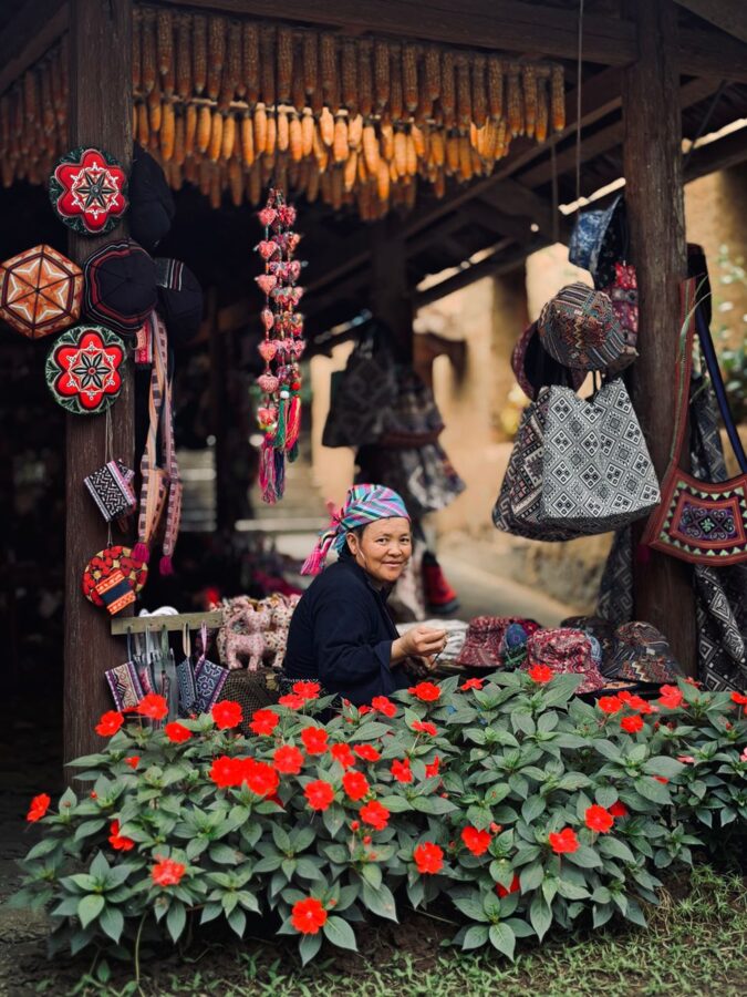
Expect to be joined on the trail by women selling textiles. Buying is optional, and a polite no thank you is enough, though you may need to say it more than once. Buy from adults, and buy because you want the thing.
Ask before you photograph anyone, and accept a no. Do not hand money or sweets to children; it keeps them on the trail and out of school. Keep your voice down in the villages in the evening, and pack shoes with real grip, a rain jacket in any month, water and a snack.
Fansipan, by cable car or on foot
Fansipan’s summit marker reads 3,143 metres, the figure from a 1909 survey. National mapping data released in 2019 puts it at 3,147.3 metres. Either way it is the highest mountain in Vietnam and in Indochina, and most people now reach the top in a cable car.
The cable car
The Sun World Fansipan Legend cable car opened in 2016. The line runs 6,292.5 metres from Hoang Lien station, in the valley below the town, to Fansipan station just under the summit, climbing 1,410 metres in about fifteen minutes. As of March 2026 it runs daily from 8:30 to 16:00.

A return ticket costs 850,000 dong (about $32) for adults and 550,000 dong (about $21) for children from 1 to 1.4 metres tall, and children under 1 metre ride free, as of June 2026. Two extras are sold alongside it: the Muong Hoa train from Sun Plaza in town down to the lower station, and a funicular from the top station towards the summit. A combined return ticket for all three is 1,370,000 dong (about $52) for adults.
| Ticket (as of 2026) | Adult | Child 1 to 1.4 m |
|---|---|---|
| Cable car, return | 850,000 dong | 550,000 dong |
| Cable car, Muong Hoa train and funicular, return | 1,370,000 dong | 1,070,000 dong (about $41) |
| Muong Hoa train, one way | 100,000 dong | not published |
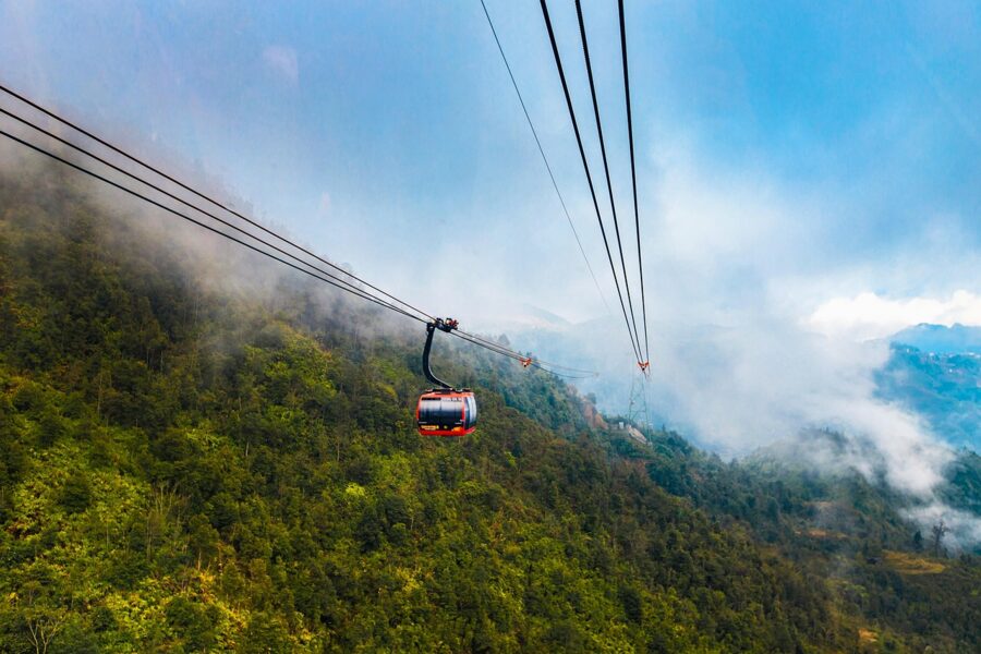
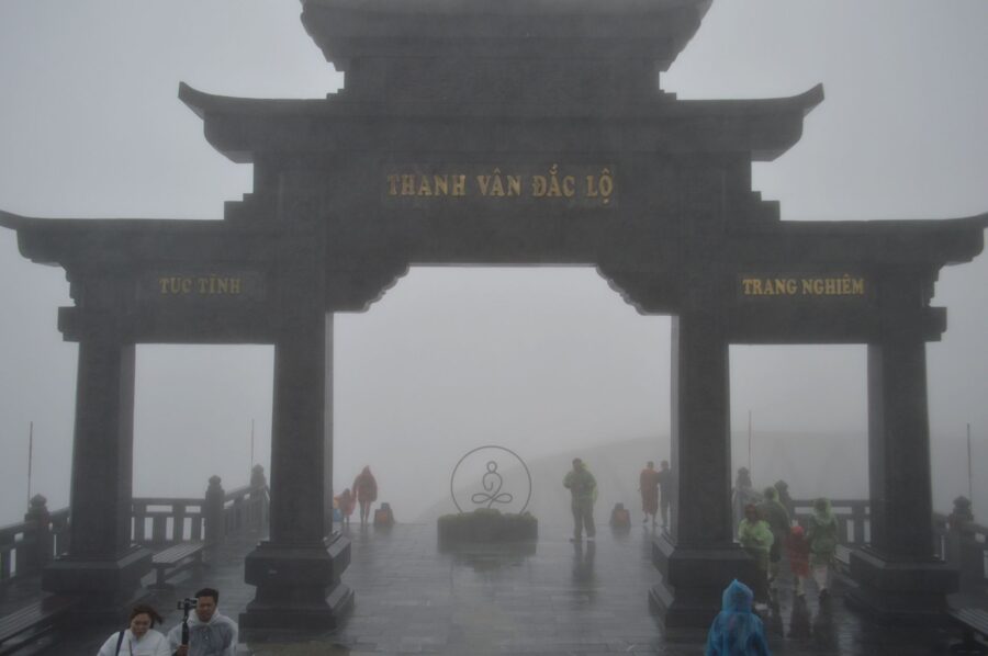
From the top station it is about 600 steps to the summit. The funicular saves most of them, and at over 3,000 metres those steps are slower going than they look. A complex of temples, a bell tower and a large Buddha statue now lines the ridge on the way.
Go early. Cloud builds over the range through the morning, and the sea of clouds in the photographs is usually an early-morning view. If the ridge is buried when you look up from town at breakfast, walk in the valley instead and try the mountain the next day.
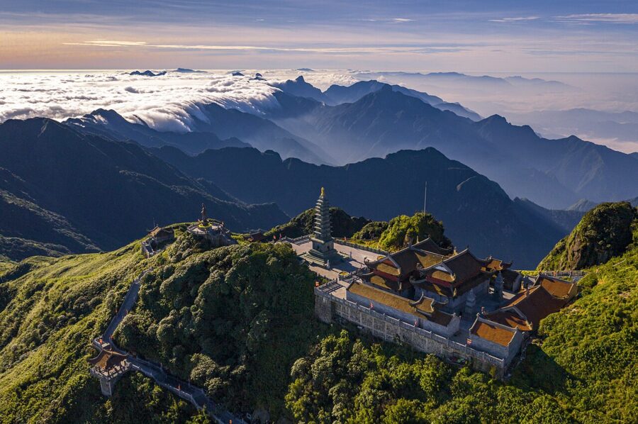

Dress for winter at the top in any month. The summit is around 1,600 metres higher than the town, and the wind makes it far colder than the Sapa forecast suggests.
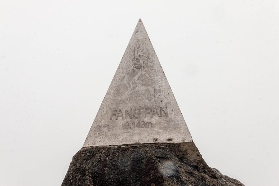

Climbing it
The old way up still exists, through Hoang Lien National Park. The usual route starts at Tram Ton, near the top of the O Quy Ho pass at around 1,900 metres, and climbs through forest and bamboo, with steel ladders on the steep sections, to a base camp at about 2,800 metres and then the summit. Most groups take two days with a night at camp. Fit walkers do it in one long day and ride the cable car down.
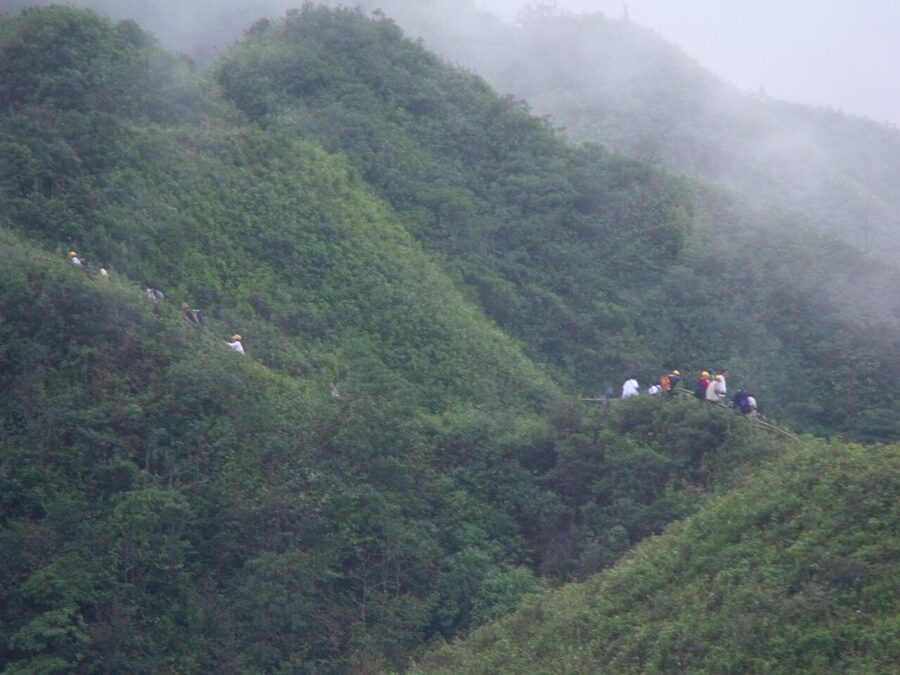
Trekkers go with a licensed guide and a park permit, and rangers check at the trailheads. Guides arrange the permit and normally include the park fee, camping gear and meals in the price, so ask what yours covers and confirm the current fee with the guide or the Hoang Lien National Park office before you go.
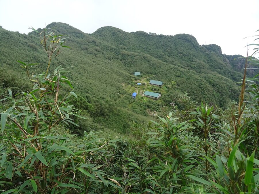

October to March gives the clearest summit days. From May to September the trail is a slide of mud, and being caught in a storm on an exposed ridge is a genuine risk.
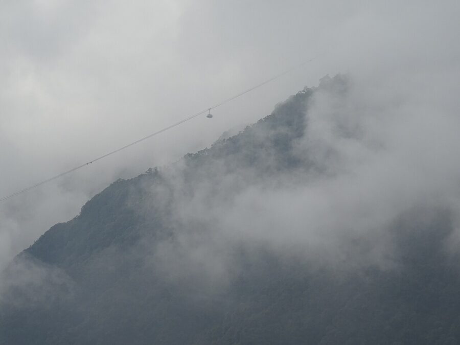

O Quy Ho pass and the waterfalls
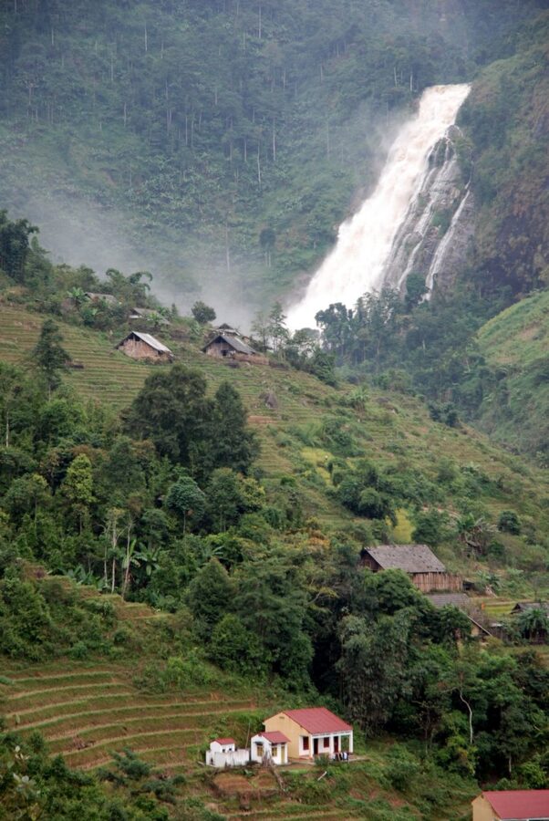
Highway 4D climbs west out of Sapa to the O Quy Ho pass, the boundary with Lai Chau province at about 2,000 metres and one of the highest road passes in Vietnam. It makes the classic half-day ride. Silver Waterfall (Thác Bạc) drops beside the road about 12 kilometres out, Love Waterfall (Thác Tình Yêu) is a walk of 1.5 to 2 kilometres into the forest from its gate, and the top of the pass is the best sunset spot near Sapa when the sky is clear.
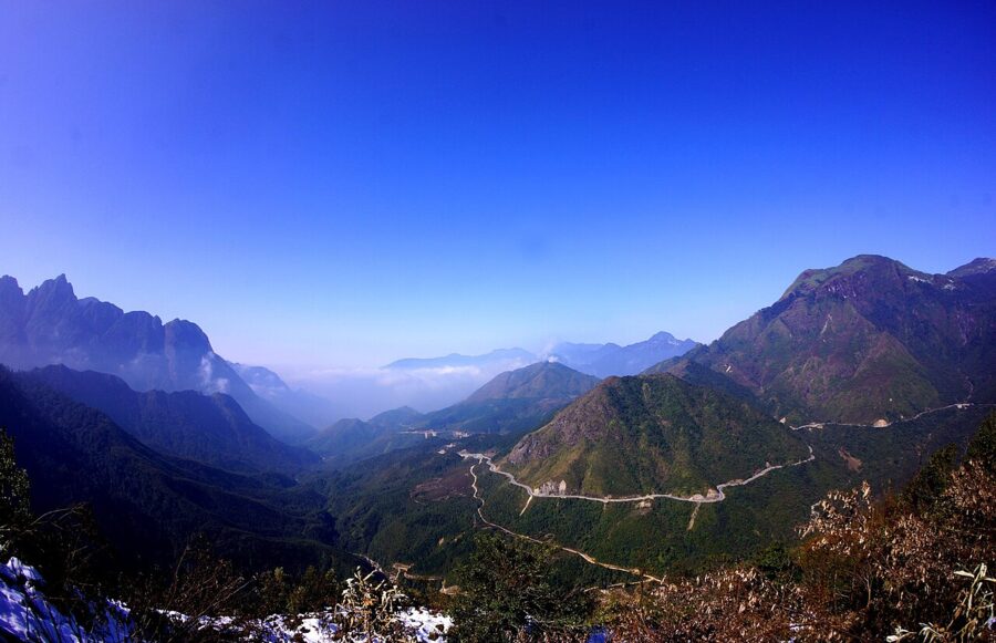

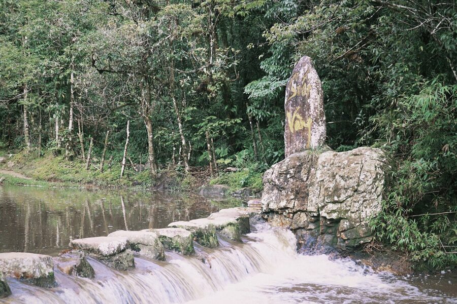
Love Waterfall is the better stop. Silver Waterfall is twenty minutes of spray beside a car park; the path to Love Waterfall follows the Golden Stream (Suối Vàng) through the national park forest, and the road noise is gone within a minute of the gate.

Change is on the way. The Hoang Lien tunnel between Sapa and Lai Chau is due in 2027 and will take through traffic off about 22 kilometres of the pass, cutting a crossing of 50 minutes to two hours down to about eleven.

If you ride it yourself, you need a valid licence. Vietnam accepts an international driving permit in the 1968 Vienna Convention format, carried with your home licence, and fines for riding without one rose sharply in January 2025 under Decree 168/2024. Motorbikes rent for 100,000 to 200,000 dong (about $4 to $8) a day in town, as of August 2026. Without the right permit, hire a car with a driver; the view is the same.
When to go: terraces, cold, fog and snow
Sapa has a mountain climate, nothing like the Delta’s. The long-term averages for the town, from the national building climate standard (QCVN 02:2022/BXD), look like this:
| Month | Average high | Average low | Rain | Rainy days |
|---|---|---|---|---|
| January | 12.3°C | 6.2°C | 70 mm | 16 |
| February | 14.3°C | 7.8°C | 74 mm | 16 |
| March | 18.2°C | 10.8°C | 105 mm | 16 |
| April | 21.3°C | 14.0°C | 213 mm | 18 |
| May | 22.4°C | 16.3°C | 341 mm | 22 |
| June | 22.9°C | 17.6°C | 381 mm | 24 |
| July | 23.0°C | 17.7°C | 461 mm | 26 |
| August | 23.0°C | 17.4°C | 452 mm | 23 |
| September | 21.7°C | 15.9°C | 303 mm | 20 |
| October | 19.0°C | 13.7°C | 201 mm | 19 |
| November | 16.1°C | 10.2°C | 106 mm | 14 |
| December | 13.2°C | 7.0°C | 66 mm | 14 |
The terraces run on the farming year. Fields are flooded and planted around May, when the valley turns into a staircase of water; they stay green through summer and ripen gold from late August into early September, the busiest weeks of the year in Sapa. After the harvest the fields are stubble until spring.

Rain is the other calendar. Sapa gets about 2,770 millimetres a year, and June, July and August each bring 380 to 460 millimetres over 23 to 26 rainy days. Trails turn to clay, landslides close roads, and the harvest view in September often comes with a day of rain on either side.
Winter is cold and foggy. January averages a high of 12°C and a low of 6°C, heating in hotels ranges from good to a fan heater, and fog can sit on the ridge for days. Snow is rare but real: it settled on the town in December 2013, and a cold wave in January 2016 brought heavy snow and a reading of minus 4.2°C.
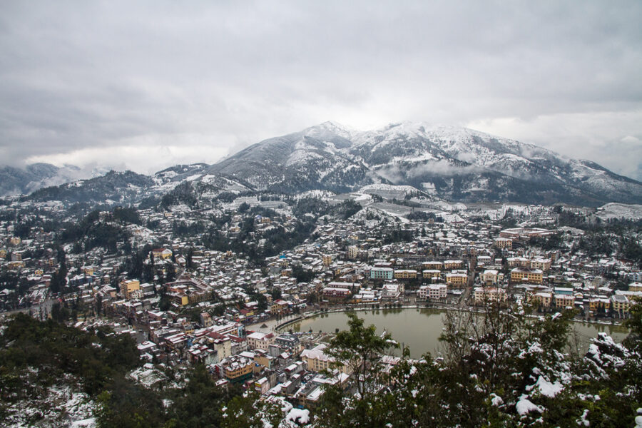

My pick is late September to November. The harvest is in or nearly in, the trails have dried out, and October and November give the best odds of a clear summit. March to May is the second choice, with blossom and planting water. Late January and February bring plum and peach blossom, and Tet crowds.
If Sapa is one stop on a longer trip, the best time to visit Vietnam as a whole is a different question, because the centre and the south run on their own rains.
Where to stay: town or valley
The choice is between convenience and the valley at night. Sapa town has every kind of hotel, the restaurants, the Muong Hoa train and the buses; it also has the noise, and from many rooms a view of the hotel across the street. A room on the Muong Hoa side, facing the valley, is worth paying more for.
Homestays in Ta Van, Lao Chai and further down the valley range from a mattress in a shared loft to rooms with private bathrooms and terrace views. In Ta Van, as of August 2026, a bed in a shared room starts at about 200,000 dong (about $8) a person and a double room at about 700,000 dong (about $27) a night. Book ahead for the September harvest and for weekends, when Hanoi empties into the mountains.
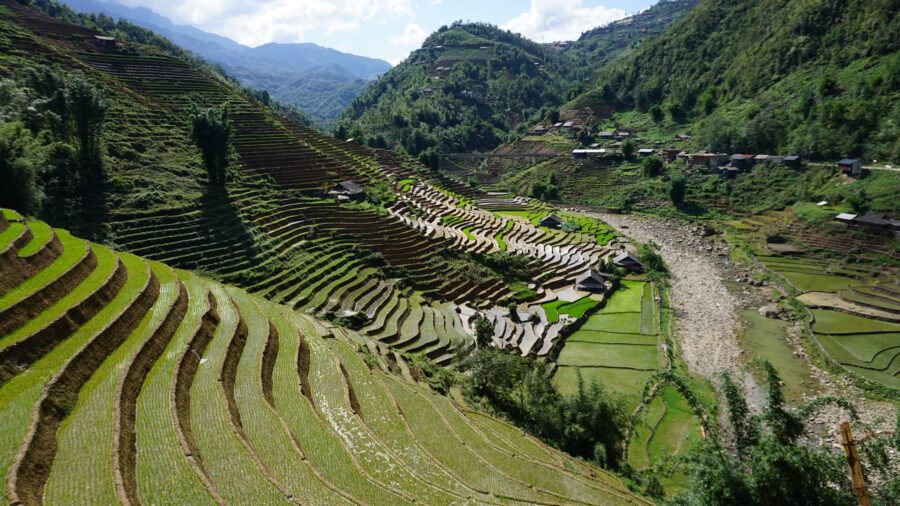
I would split it: a night in town to arrive and do Fansipan, then one or two nights in the valley. After the day walkers leave, Ta Van is quiet, and the trails and a Dao herbal bath are on your doorstep.
Some homestays are family houses with a room upstairs; others are guesthouses built for the trade. If staying with a family is the point, ask whether the hosts live there and eat with guests before you book.
What to eat
Sapa food is built for cold nights. The famous dish is thắng cố (a stew of horse meat and offal), the Hmong market dish cooked in a wide pan. It is strong; versions made with beef or buffalo are common in town and easier going.
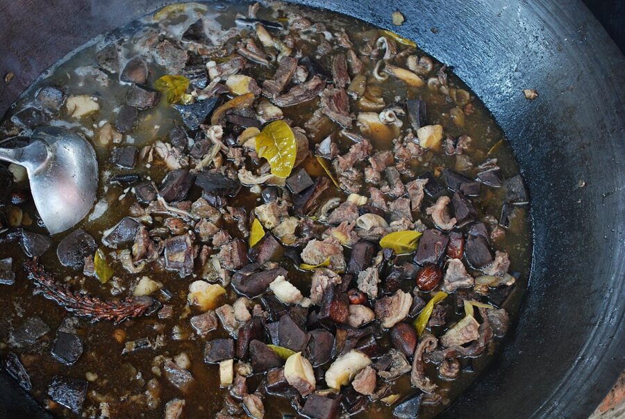

The surer bets are grilled skewers and cơm lam (sticky rice cooked in bamboo) from the evening stalls near the church, black chicken, and hotpot with salmon or sturgeon, which are farmed in the cold streams around Sapa and on almost every menu in town. Rượu táo mèo (wild mountain apple steeped in rice wine) is the bottle people take home.
Bac Ha and a Sunday market
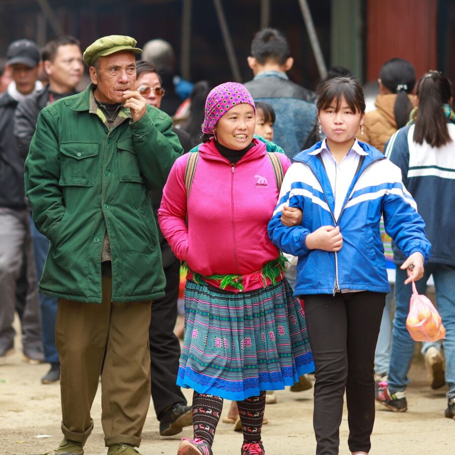
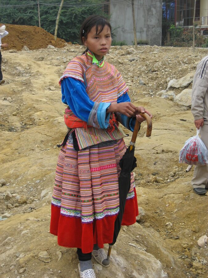
Sapa’s own market trades every day, but the big highland market is at Bac Ha, roughly 100 kilometres away, on Sunday mornings. Flower Hmong traders come in from the hills in layered, brightly embroidered costume, and the buffalo and horse trading at the back is the part that has not changed for visitors.
It is a full day from Sapa, two and a half to three hours each way, so leave at dawn. On any other day of the week, skip it.

How many days, and how Sapa fits a trip
Three days and two nights is right for a first visit: a day for Fansipan and the town, a day walking the Muong Hoa Valley to a homestay, and a morning of slack for the weather. Two nights is the minimum; one night is a lot of travel for what may be a foggy day.
On a ten-day Vietnam itinerary, Sapa takes two days by night train both ways from Hanoi. If you only have one spare day from Hanoi, Sapa is the wrong trip: Trang An in Ninh Binh works as a day trip and Sapa does not.
Sapa and Ha Long Bay pull in opposite directions from Hanoi, one north-west and one east, so most short trips pick one. And Lao Cai is a border crossing into China: if you are tempted to step across, check first that your Vietnam e-visa allows multiple entries, because a single-entry visa ends when you leave the country.
Book the cable car for your first clear morning, not your first morning. The valley will wait; the view from the top might not.