
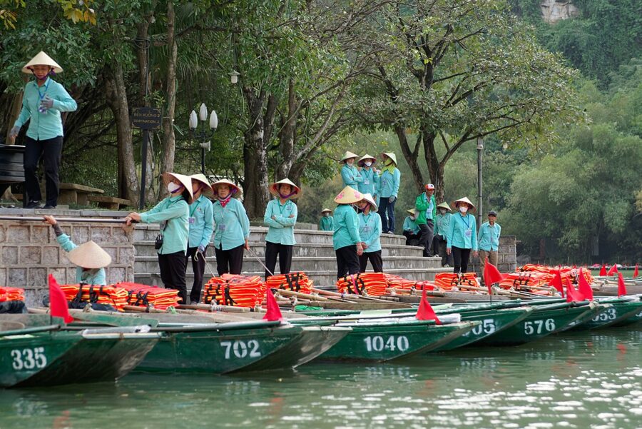
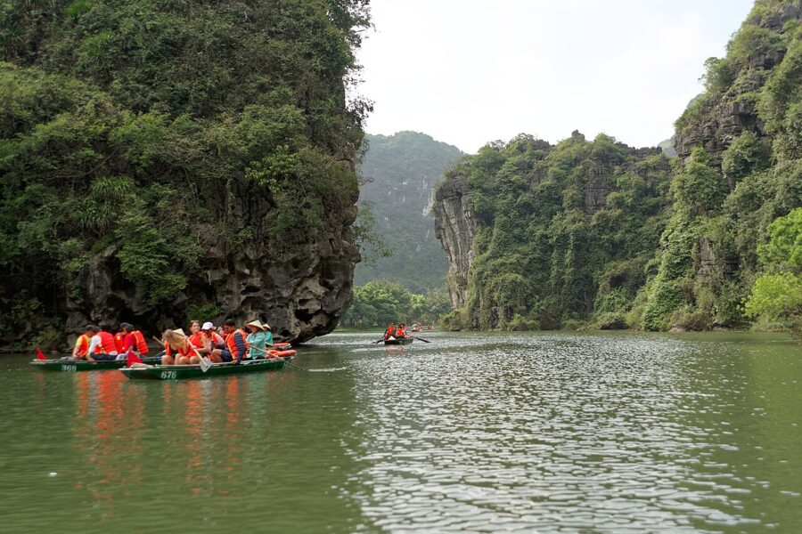
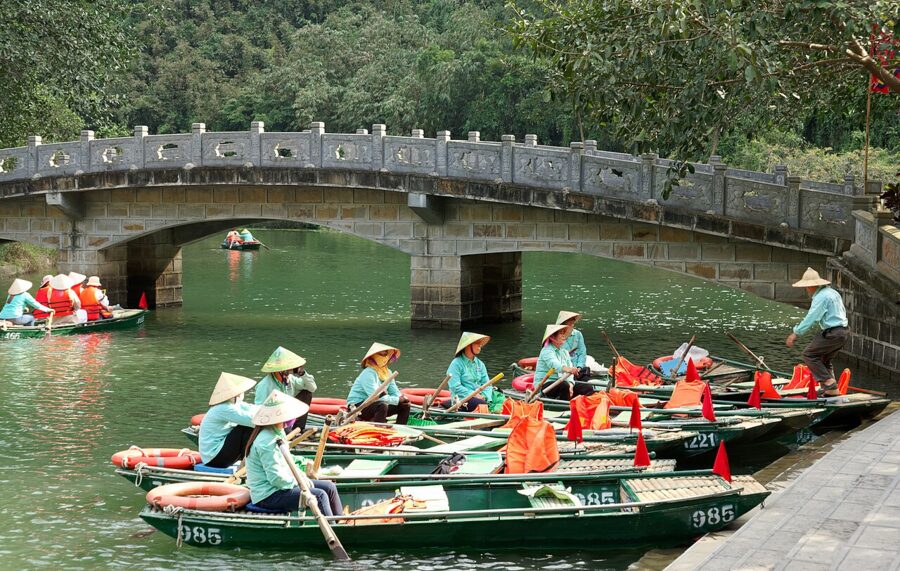
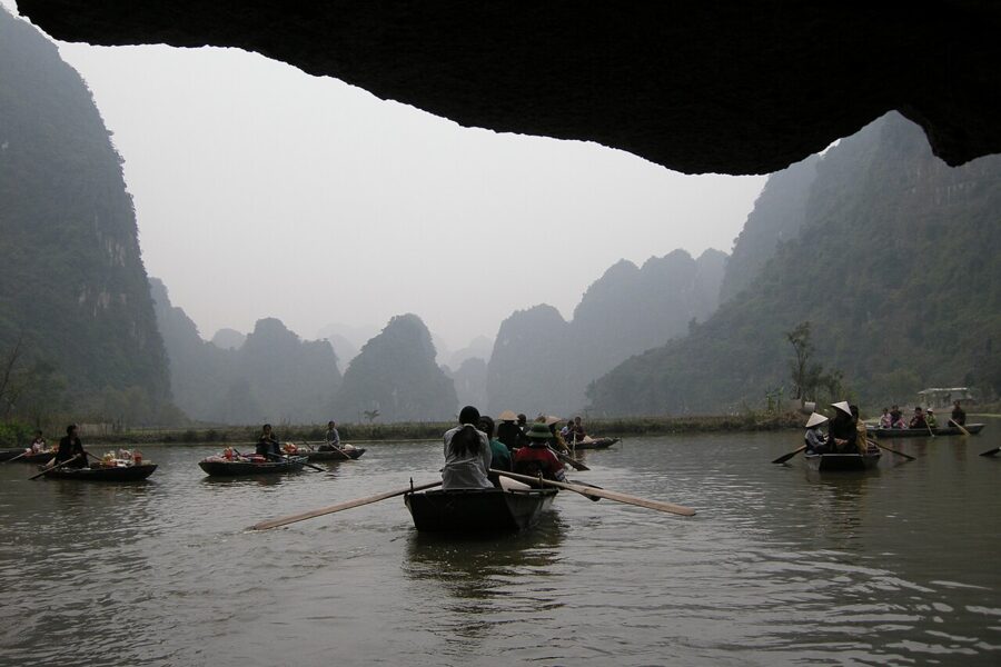
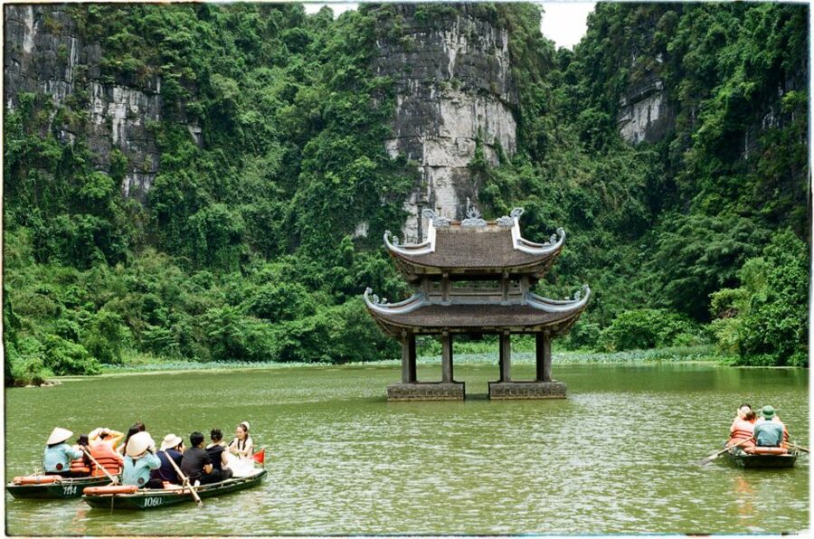
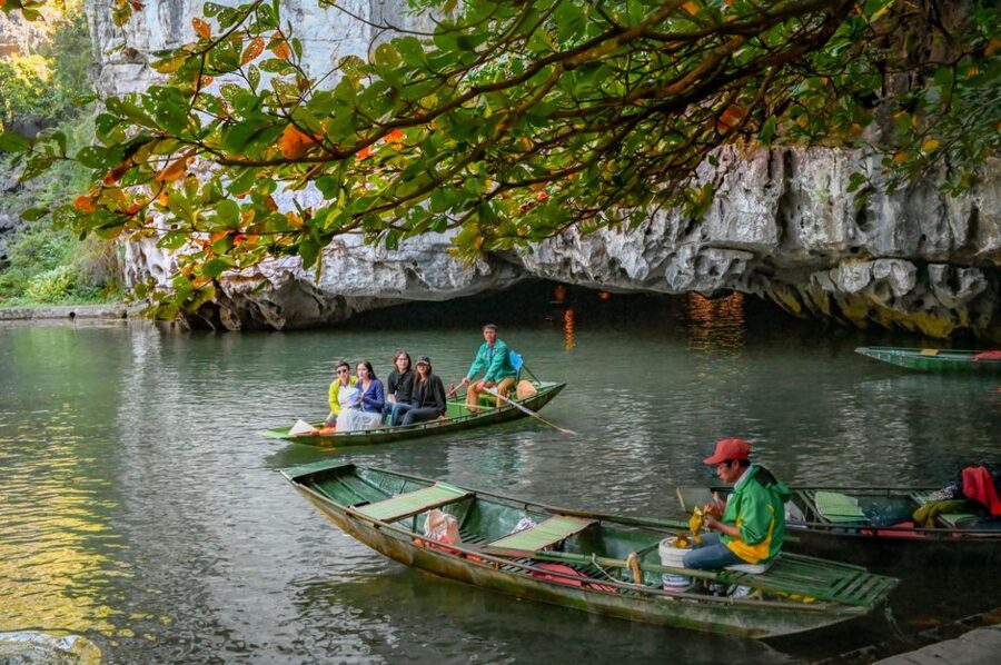
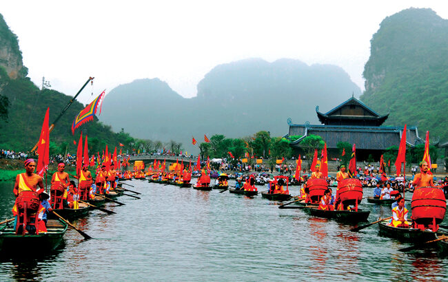
The rowers at Trang An push their oars with their feet. It leaves their hands free to steer, point and, on route 1, warn you about the next cave roof, because there are nine caves on that loop and some clear the boat by less than a seated head. Which caves you pass, which temples you climb to and how long you sit on a hard plank all depend on a route number you choose at the ticket desk, so that is the decision to get right.
Trang An (Tràng An) is the middle and busiest part of a UNESCO World Heritage area in Ninh Binh province, about 90 to 100 kilometres south of Hanoi. The same protected area takes in the older boat trip at Tam Coc, the viewpoint at Hang Mua and the 10th-century capital at Hoa Lu. On its northern edge sits Bai Dinh, a pagoda complex built at enormous scale since 2003. People call the whole thing “Ha Long Bay on land”, which is fair for the limestone and misleading for almost everything else.
It is also popular to the point of strain. Ninh Binh province counted about 17.6 million visitors in the first half of 2026, up more than 23 per cent on a year earlier, and Trang An takes the largest share at weekends and holidays. None of that spoils it if you plan by route, by hour and by season.

Contents
- What the Trang An landscape is, and why UNESCO listed it
- The Trang An boat trip: routes, tickets and timing
- Tam Coc: the river through the rice
- Hang Mua: about 500 steps for the view everyone posts
- Bai Dinh: big, new and a long walk
- Hoa Lu, the first capital
- How to fit them together
- A day trip from Hanoi, or a night in Ninh Binh?
- Getting there
- Getting around: bicycle, motorbike or car
- Seasons: the rice harvest, the crowds and the heat
- Eating around Trang An
What the Trang An landscape is, and why UNESCO listed it
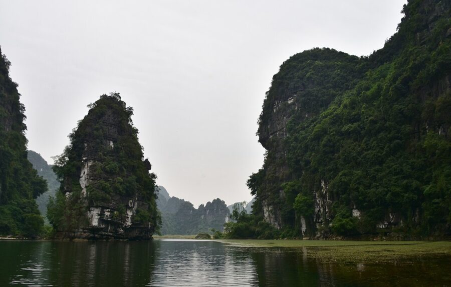
The Trang An Landscape Complex (Quần thể danh thắng Tràng An) was inscribed on the World Heritage List on 23 June 2014, at the committee’s meeting in Doha. It was Vietnam’s first mixed site, listed for both nature and culture, and it is still the only one in Southeast Asia. It covers about 6,226 hectares in three linked parts: Hoa Lu to the north, the Trang An eco-tourism area in the middle, and Tam Coc and Bich Dong to the south.
Two of the three criteria are about the rock. The towers here are limestone laid down around 250 million years ago, then worn by rain, rivers and repeated invasions of the sea into enclosed valleys joined by water caves. In November 2026 the International Union of Geological Sciences added “Trang An Tropical Karst” to its third list of 100 geological heritage sites, as a karst once eroded by the sea and later raised back onto land.
That is the real difference from Ha Long Bay. Ha Long is the same kind of karst drowned by the sea, so you sail around islands. Trang An is karst the sea gave back, so you are rowed through the mountains, along streams that run under them.

The third criterion is about people. Caves at different heights hold traces of human life over more than 30,000 years, left by hunter-gatherers who ate mountain snails and river fish and moved as the sea advanced and retreated. In 968 Dinh Bo Linh made Hoa Lu the capital of Dai Co Viet, with the valleys of Trang An as its southern defences. The early Tran kings later used the same hidden valleys as a base against the Mongols, the story behind several temples on the boat routes.

The Trang An boat trip: routes, tickets and timing
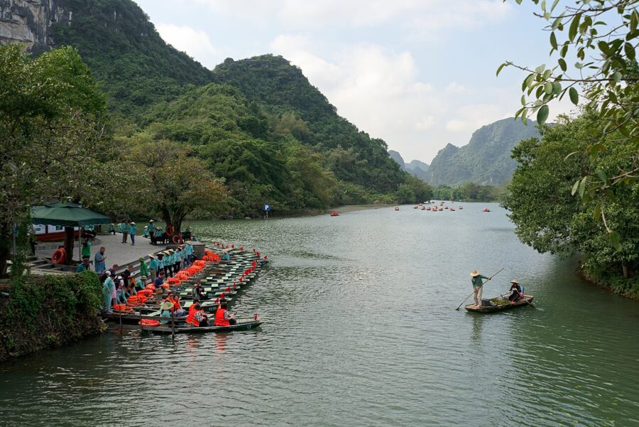
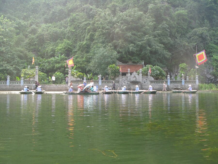
Everything starts at the Trang An wharf (bến thuyền Tràng An), on the road between the old city of Ninh Binh and Hoa Lu, about seven kilometres west of the centre. You buy a ticket, queue by route and are put in a boat with a rower. Boats are filled to a set number, so couples and solo travellers usually share with strangers; ask at the counter if you want a boat to yourself.
Ticket prices
Trang An raised its prices on 1 January 2026. The ticket covers the boat and entry to the scenic area, whichever route you choose.
| Ticket (from 1 January 2026) | Price |
|---|---|
| Adult, or anyone taller than 1.3 m | 300,000 dong (about $11) |
| Child 1 m to 1.3 m tall | 150,000 dong (about $6) |
| Child under 1 m | Free |
A guide who rides with you to explain the temples and the geology costs extra; the rowers row, and explaining is not their job. The price board at the wharf counter shows the current guide fee.

The three routes
All three loops start and finish at the same wharf and cross open water between the caves, with no shade. The times below are for the boat alone. Add more if you climb to every temple, and more again on a holiday, when boats queue at the cave mouths.
| Route | Roughly | What it passes |
|---|---|---|
| Route 1 (tuyến 1) | 3 to 3.5 hours | Nine caves, among them Hang Toi, Hang Sang, Hang Nau Ruou, Hang Ba Giot and Hang Quy Hau; Trinh temple, Tran temple, Khong palace and Bao Hieu pagoda |
| Route 2 (tuyến 2) | 2.5 to 3 hours | Four caves, including Hang Lam, Hang Vang and Hang Dai; Cao Son temple, Suoi Tien temple, the Vu Lam royal palace and the valley where Kong: Skull Island was filmed |
| Route 3 (tuyến 3) | About 3 hours | Three caves, including Hang May, at more than a kilometre the longest; Trinh temple, Suoi Tien temple, the Vu Lam palace and the Kong valley |

Which route I would take
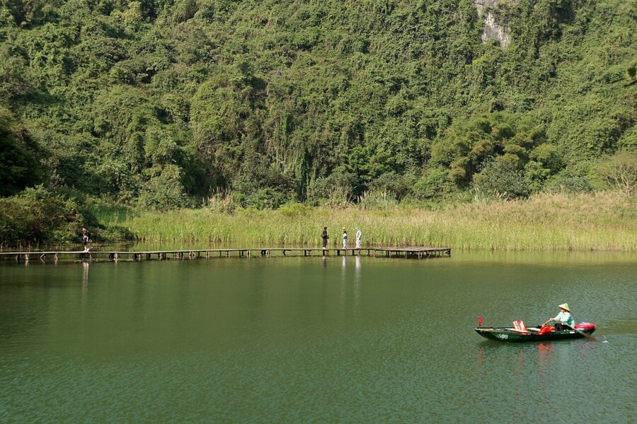
Route 1 is the one for caves. Nine of them plus three temple stops make it the most varied loop, and the film-set crowds go the other way. The catch is time: three hours and more on a hard bench with your knees near your chin, and the open stretches are hot after ten in the morning.

Route 2 is the most popular, mainly for the Vu Lam palace and the Kong valley, and it shows. I would skip it unless the film matters to you. Route 3 is the better compromise: fewer caves but the longest one, and the same Vu Lam stop. It was also the route closed when the caves flooded in July 2026, so have a second choice ready in the rainy season.

The stops along the way
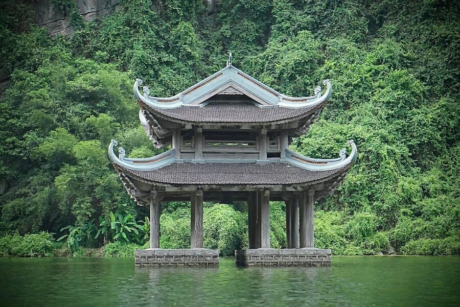
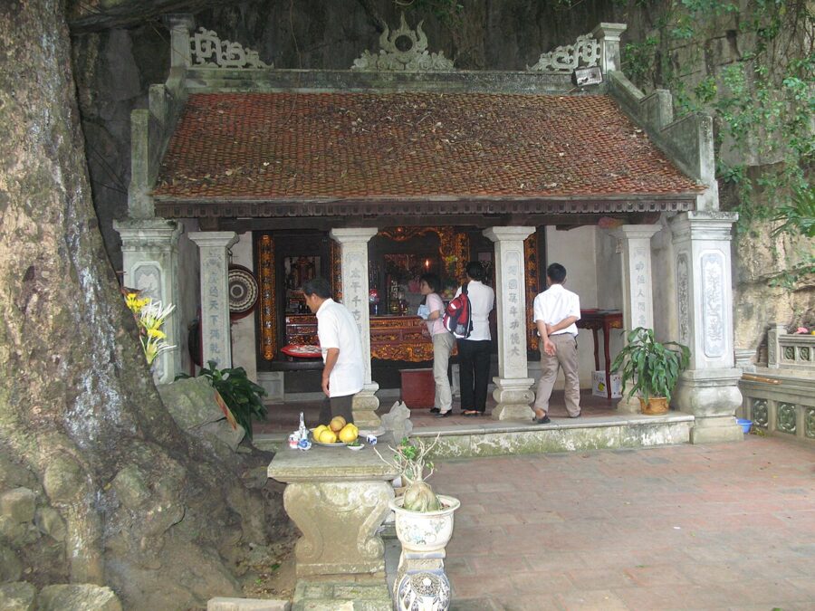
Each temple stop adds 15 to 30 minutes. Trinh temple (Đền Trình), near the start of routes 1 and 3, is traditionally where you announce yourself before entering the sacred area. Tran temple (Đền Trần) on route 1 means a climb of stone steps from the landing, worth it for the quiet courtyard while boats pile up below.

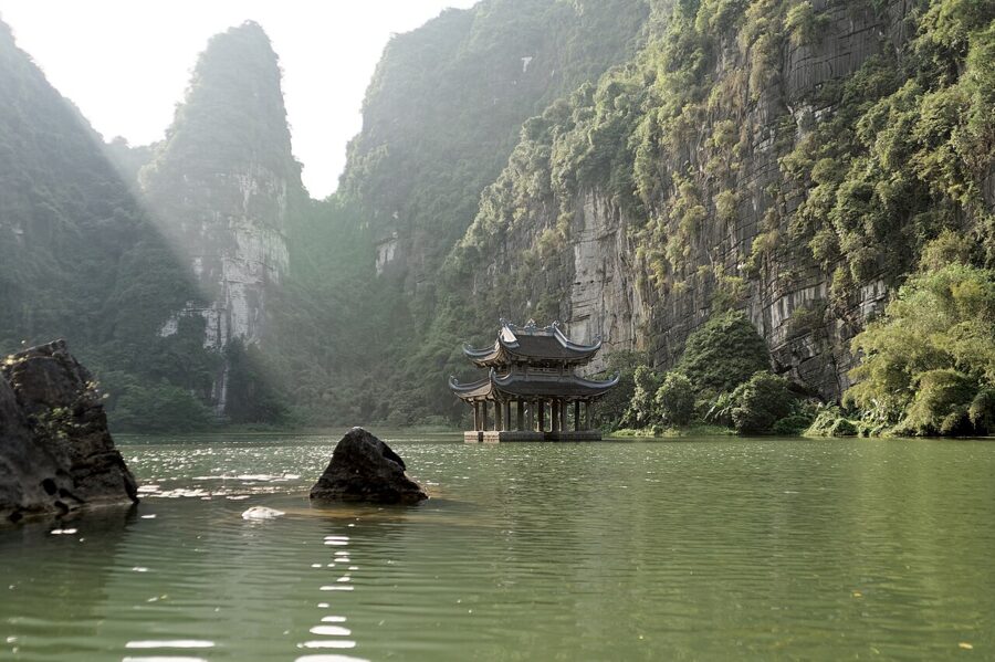
The Vu Lam royal palace (Hành cung Vũ Lâm) on routes 2 and 3 marks where the early Tran kings gathered forces before their counter-attack in the second Mongol war. What stands there now is a restoration, set in a broad lake valley. The Kong: Skull Island valley gets more attention than it deserves: the 2017 film shot scenes here, but you came for the caves.

When water or weather closes a route
Caves flood. On 31 July 2026, after days of heavy rain, the management board closed route 3 because water in some caves had passed the safe level, and moved passengers to routes 1 and 2. Route 3 reopened on 2 August. The board says rising water is an annual event in the rainy season and it will close routes again whenever levels are unsafe.
Whole days are cancelled too. Trang An stopped admitting visitors on 9 November 2026 because of heavy rain and strong wind, and turned people away in September 2024 as Typhoon Yagi came through. It also shut on the first days of Tet in 2026, 16 and 17 February. If the forecast looks wild, check the closure notices posted by Ninh Binh’s tourism promotion centre, or ask your hotel to call the wharf, before you leave Hanoi.
Tips and touts
Tipping the rower is voluntary; your ticket pays for the boat. A small note at the end is a fair thank-you for three hours of rowing, but nobody can make it compulsory. In mid-November 2026, Ninh Binh’s culture and tourism department said it was checking a guide’s report that a rower at Tam Coc had grabbed foreign passengers’ hands to demand more. If that happens at either wharf, report it at the ticket office.
Bring water, a hat and sunscreen, and keep valuables in something that zips. Cover shoulders and knees for the temple stops. You do not need to book ahead at Trang An or Tam Coc; tickets are sold at the wharf on the day.
Tam Coc: the river through the rice
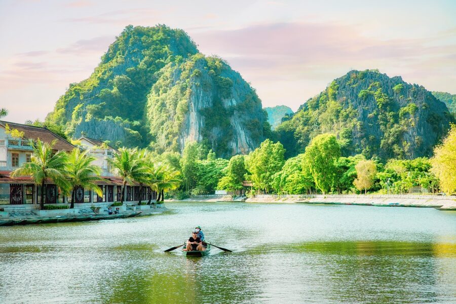
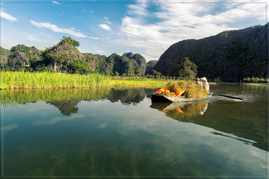
Tam Coc (Tam Cốc) is the older boat trip, at the southern end of the protected area. Its name means “three caves”, Hang Ca, Hang Hai and Hang Ba, and boats go through all three on the Ngo Dong river (sông Ngô Đồng), about two hours there and back from the Van Lam wharf. Hang Ca is 127 metres long; the other two are much shorter.

The difference is the scenery between the caves. At Tam Coc the river runs through rice fields, so the trip changes colour with the crop, from flooded silver to green to gold. Trang An has more caves, more temples and almost no farmland. With one day, choose Trang An; with two, save Tam Coc for when the rice is ripe.
The province’s March 2025 price list gives the Tam Coc ticket as 250,000 dong (about $10) for adults, covering the boat plus Thai Vi temple, Tien cave and Bich Dong pagoda, or 350,000 dong (about $13) with the electric cart between them. Trang An and Hang Mua have raised prices since that list appeared, so check the board at the Van Lam wharf.
Bich Dong pagoda and Thai Vi temple
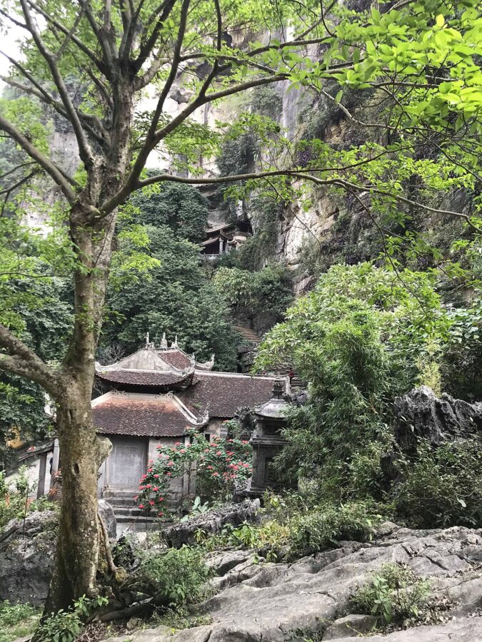
Two kilometres from the Tam Coc wharf, Bich Dong pagoda (chùa Bích Động) climbs a limestone outcrop in three stages, lower, middle and upper, linked by steps and a cave. The scholar-official Nguyen Nghiem, father of the poet Nguyen Du, named it “green cave” in 1773. A water cave, Xuyen Thuy, runs about 350 metres through the same mountain.
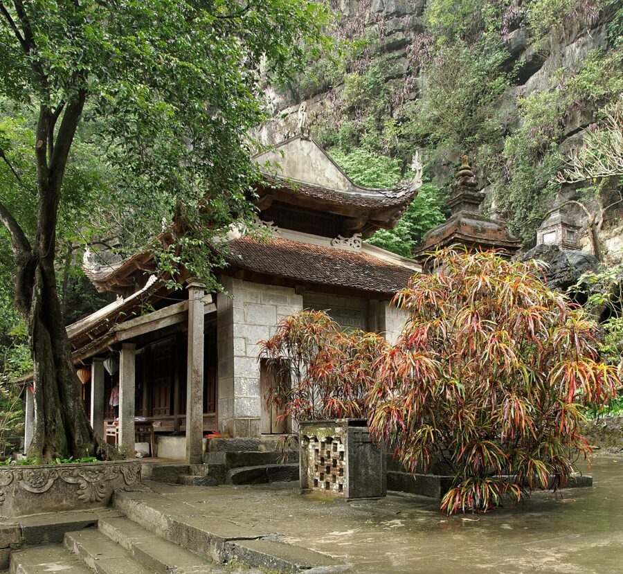

Thai Vi temple (đền Thái Vi), reachable from the river or by road, honours the Tran kings who fought the Mongols from these valleys. Both are easy by bicycle from Tam Coc town in a morning.


Hang Mua: about 500 steps for the view everyone posts
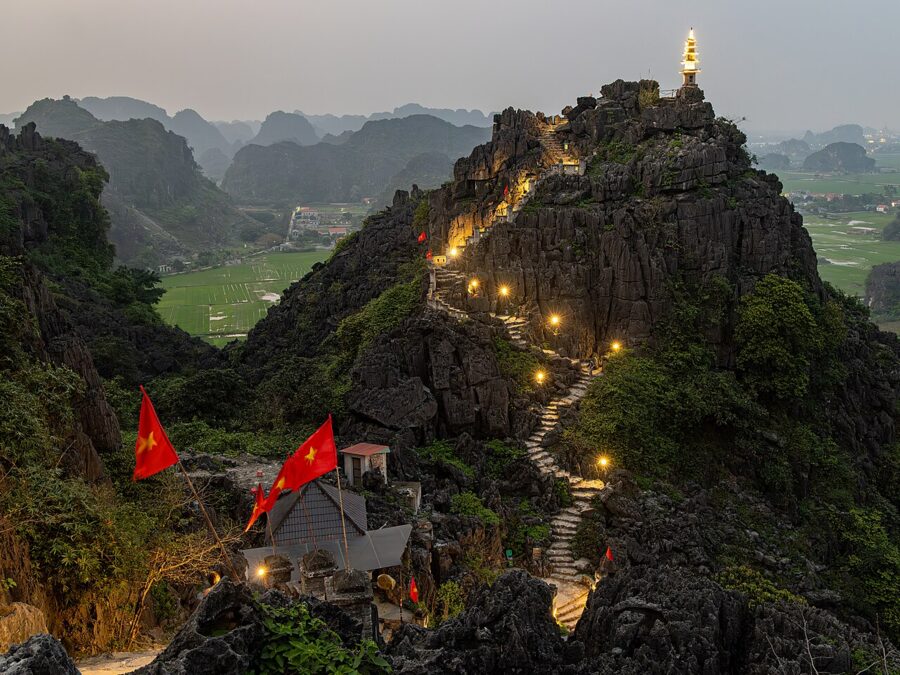
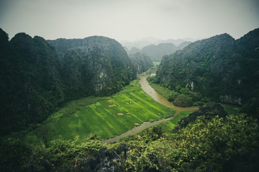
Hang Mua (Hang Múa) is a limestone peak just north of Tam Coc with a stone stairway up its ridge, about 500 steps by most counts, to a small tower at the top. From there you look straight down on the loops of the Ngo Dong. It is the view on most Ninh Binh postcards, and it is that good.
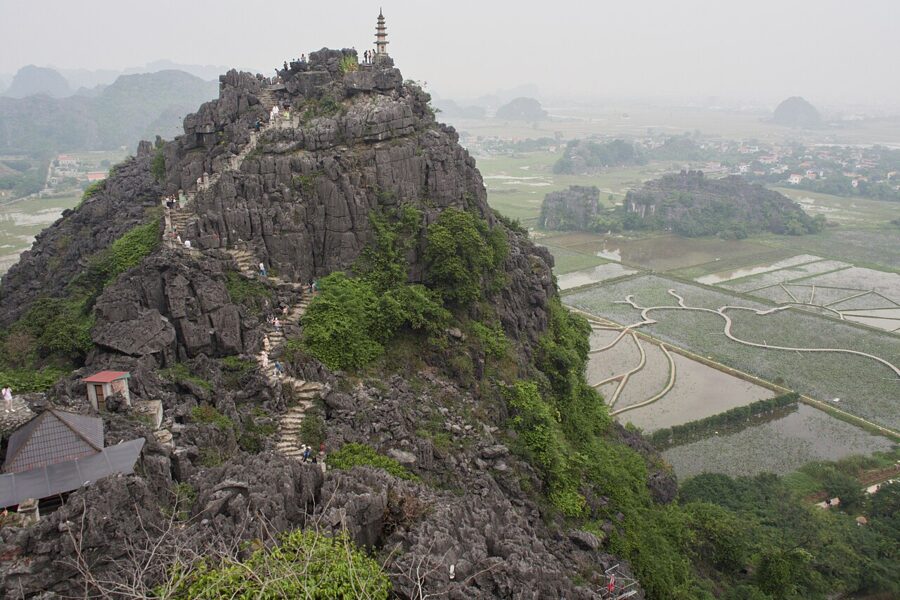
The operator raised the entry price on 1 April 2026 to 150,000 dong (about $6) per person, with children under 1 m free. The ticket covers the grounds at the foot of the peak as well as the climb.
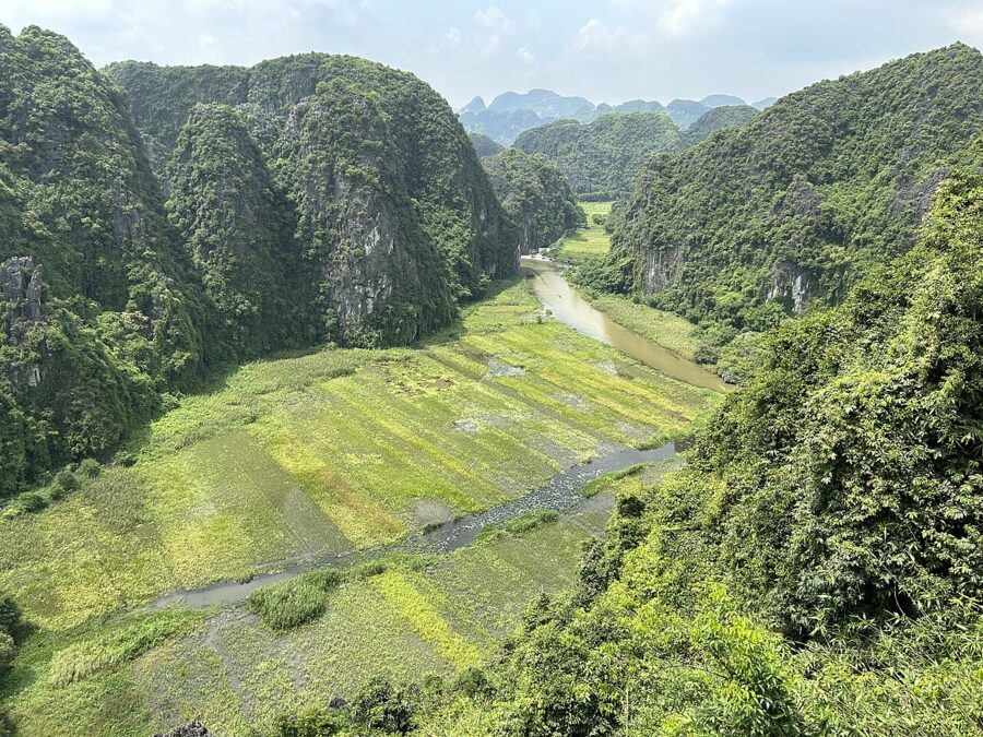

Timing decides whether the climb is pleasant or punishing. The stairway faces the full sun, so in summer go early or in the last hours of the afternoon, with more water than you think you need. Sunset draws the biggest crowd. A clear early morning gives the same view with mist in the valleys and far fewer people.

Bai Dinh: big, new and a long walk
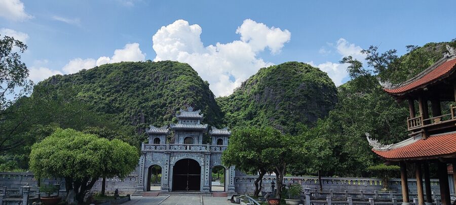
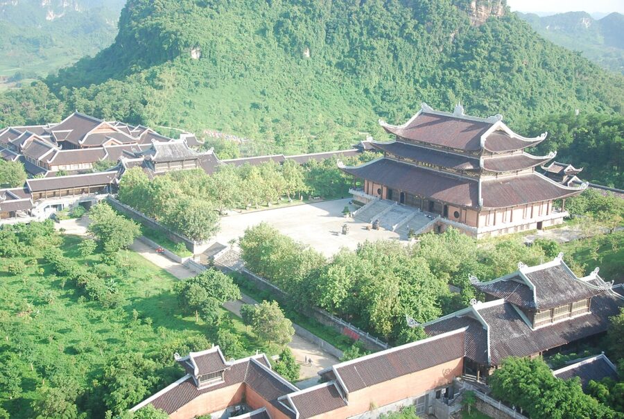
Bai Dinh pagoda (chùa Bái Đính) has two halves. The old pagoda, up more than 300 steps, is linked to the 12th-century monk Nguyen Minh Khong and has prayer caves and a temple to the mountain god Cao Son. The new pagoda, built from 2003 on the opposite slope, is what the coaches come for. The whole complex covers 539 hectares.
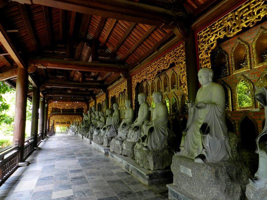

The numbers explain both the appeal and the doubts. The covered arhat corridor runs 1,052 metres up the hill. The Tam The hall holds three bronze Buddhas of 50 tonnes each, the Phap Chu hall a 100-tonne bronze Buddha 10 metres tall, and the bell tower a 36-tonne bell. The 13-storey stupa rises about 100 metres.


Is it worth your time? If you like scale and want to see Buddhism as practised in Vietnam now, yes: on a festival day it is packed with pilgrims. If you have one day and came for the karst, skip it. Almost everything here was built this century, and the walk from the gate to the top halls is long and exposed.
There is no ticket to enter the grounds; you pay for the electric cart from the car park and for the stupa. On the province’s March 2025 list a return cart ride was 100,000 dong (about $4) and cart plus stupa 150,000 dong (about $6), so check the board at the gate for current prices. The spring festival opens in the first lunar month, usually February, and those weeks are the busiest of the year.
Hoa Lu, the first capital
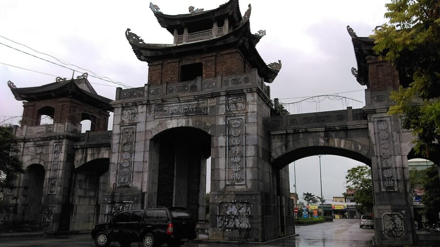
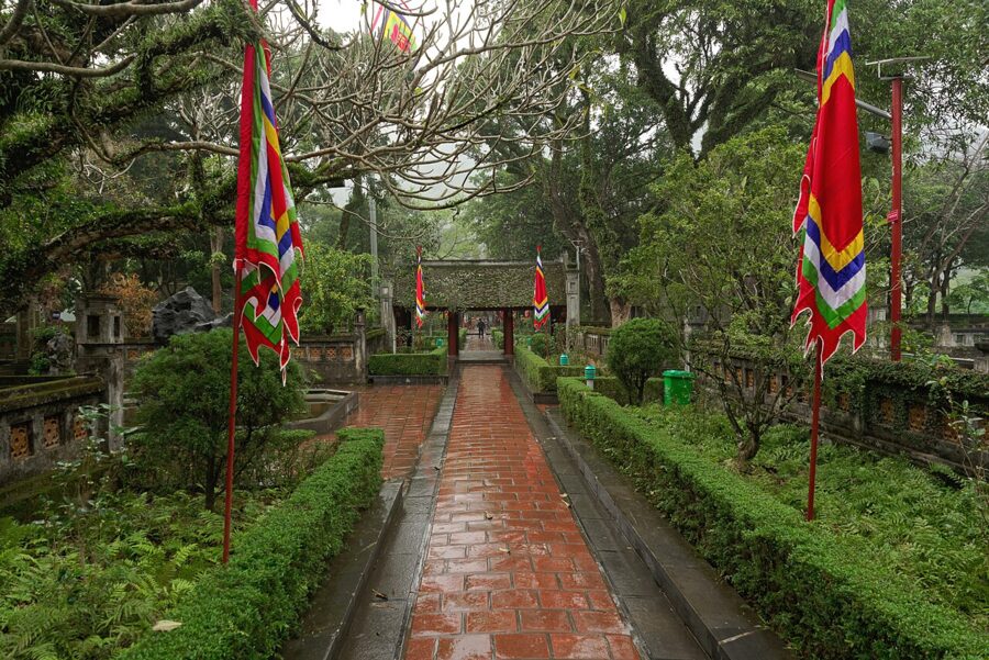
Hoa Lu (cố đô Hoa Lư) was the capital from 968 to 1010, under the Dinh, the Early Le and the first Ly king, until Ly Thai To moved the court to Thang Long, today’s Hanoi. It was chosen for defence: limestone walls enclosed the valleys, and builders closed the gaps between peaks with ramparts.

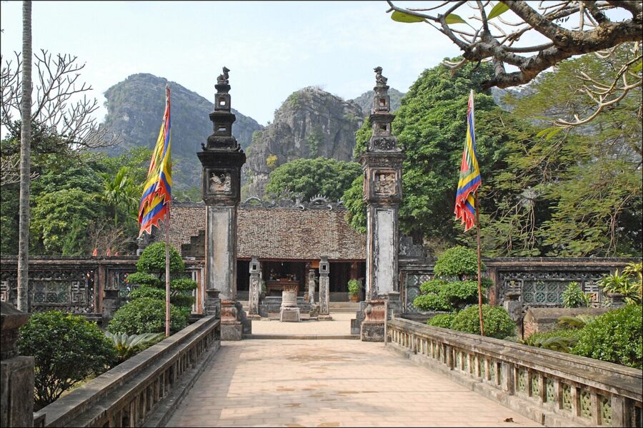
You visit two temples, to King Dinh Tien Hoang and King Le Dai Hanh, in buildings dating from around the 17th century on the site of the old palace. Near the Le Dai Hanh temple, archaeologists have exposed part of a 10th-century palace floor about three metres down, with bricks stamped for the walls of Dai Viet.

Hoa Lu is small, quiet and cheap, at 20,000 dong (under $1) on the province’s 2025 list, and only three or four kilometres north of the Trang An wharf. That makes it the easiest add-on to a boat trip. An hour is enough.

How to fit them together
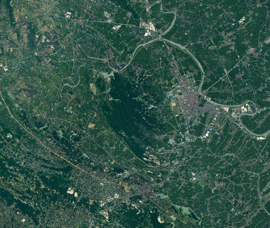
Hoa Lu is in the north, the Trang An wharf in the middle, Hang Mua and Tam Coc to the south, and Bai Dinh off to the north-west. Trang An to Tam Coc is about 20 minutes by car. One day gives you one boat trip done properly and one other site; two days cover most of it without hurrying.
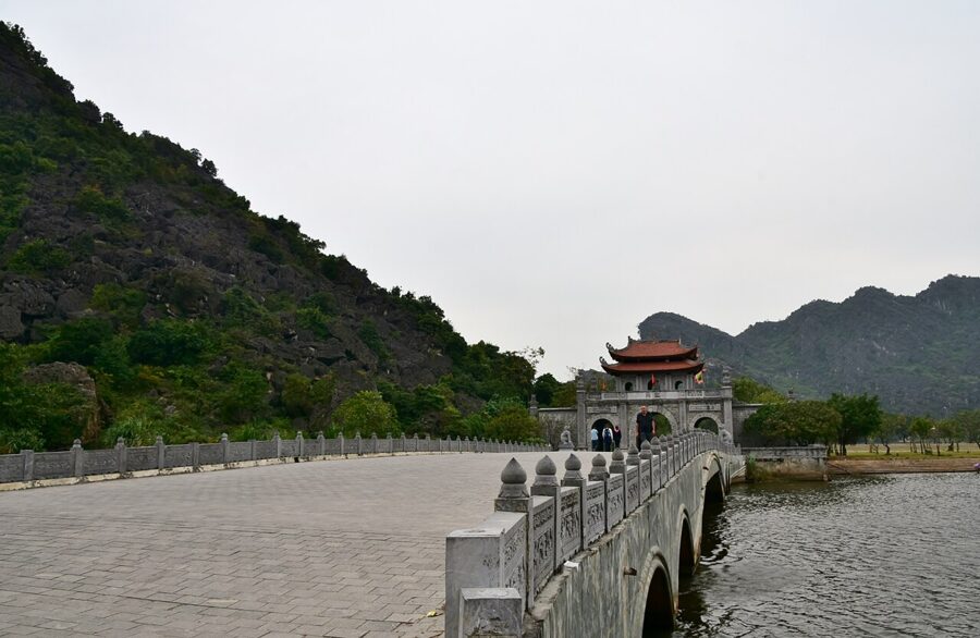

- One day, history too: the Trang An boat (route 1 or 3) first thing, lunch, then Hoa Lu.
- One day, views first: the boat in the morning, a rest through the heat, Hang Mua in the late afternoon.
- Two days: arrive by early afternoon and climb Hang Mua. Next morning take the first boats at Trang An, then Hoa Lu, and finish with Bich Dong and Thai Vi by bicycle. Add Bai Dinh only if it really interests you.
A day trip from Hanoi, or a night in Ninh Binh?
A day trip works, and most visitors do it that way. The road from Hanoi takes about two hours on the expressway. The trouble is that everyone arrives together: day tours reach the wharf mid-morning, just as the queues peak and the open water heats up.
A night changes the trip more than any other choice. Sleep near Tam Coc or Trang An and you can be on the water when the wharf opens and on Hang Mua at sunset. If your list of things to do in Hanoi is already long, a night here costs only one more day. Ninh Binh is south of Hanoi, while Sapa and Ha Long lie north-west and east, so fit it before or after those trips, not between them.
If you take a tour
A fair day tour includes the return transfer, the Trang An or Tam Coc boat ticket, lunch and a guide who speaks your language, plus one more stop such as Hoa Lu, Bai Dinh or Hang Mua. Check that list before you book. The boat ticket and the Hang Mua entry, 450,000 dong (about $17) between them, are the costs most often left out. Ask which route your boat will take.
Getting there
Ninh Binh has no airport. Flying in from abroad, you land at Hanoi’s Noi Bai, with your Vietnam e-visa or visa exemption sorted first.
By train
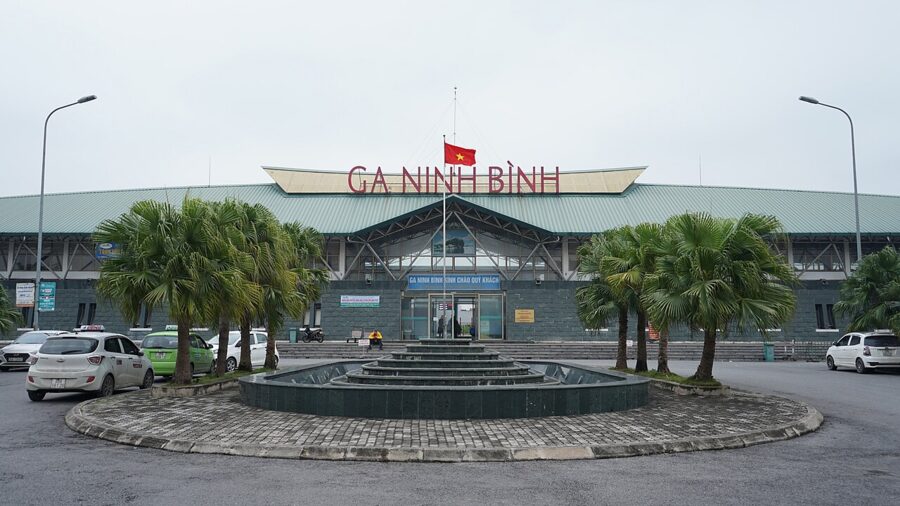
Ninh Binh station (ga Ninh Bình) is on the north-south line, and several long-distance SE trains from Hanoi stop there, taking roughly two to two and a half hours. Timetables and fares change through the year, so check them with Vietnam Railways, online or at the station. The station is in the city centre, 15 to 20 minutes by taxi from Trang An or Tam Coc.

By bus or limousine van
Ordinary buses leave Hanoi’s Giap Bat bus station through the day. More comfortable are the nine-seat “limousine” vans that collect from Old Quarter hotels and drop at hotels in Ninh Binh, Tam Coc or Trang An. As of late 2025 these typically cost 150,000 to 250,000 dong (about $6 to $10) one way.
By car
A private car with driver costs roughly 1.2 to 1.6 million dong (about $45 to $60) one way as of late 2025. For three or four people it is good value, and you can leave Hanoi early enough to be on the water before the tours.
Getting around: bicycle, motorbike or car
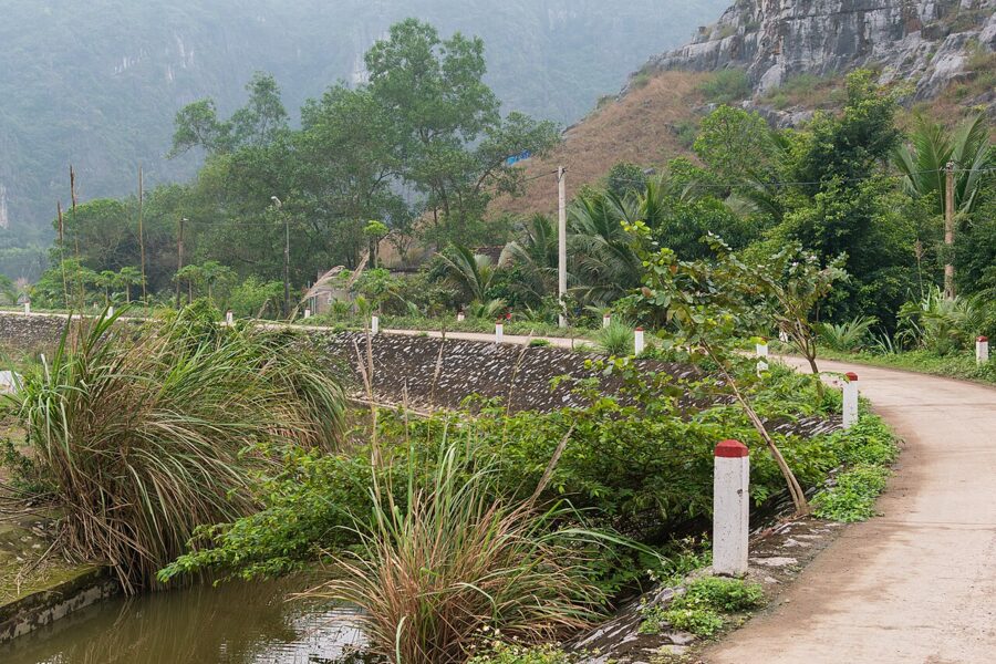
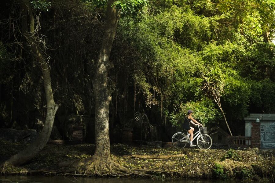
The valley floors are flat and the back roads lovely, so a bicycle is the best way to see the southern half. From Tam Coc town you can ride to Bich Dong, Thai Vi and the foot of Hang Mua in a morning, and on to Trang An in about another half-hour. Most guesthouses rent bikes. Ride early, carry water and keep to the back lanes.

A motorbike puts Bai Dinh and Hoa Lu in the same day, but you need a licence valid in Vietnam, and your travel insurance may not cover you without one. A car or ride-hailing app suits the midday heat, the evenings and the longer run to Bai Dinh.
Seasons: the rice harvest, the crowds and the heat
Ninh Binh has the northern climate, with a cool, grey winter and a hot, wet summer. For the whole country region by region, see the best time to visit Vietnam.
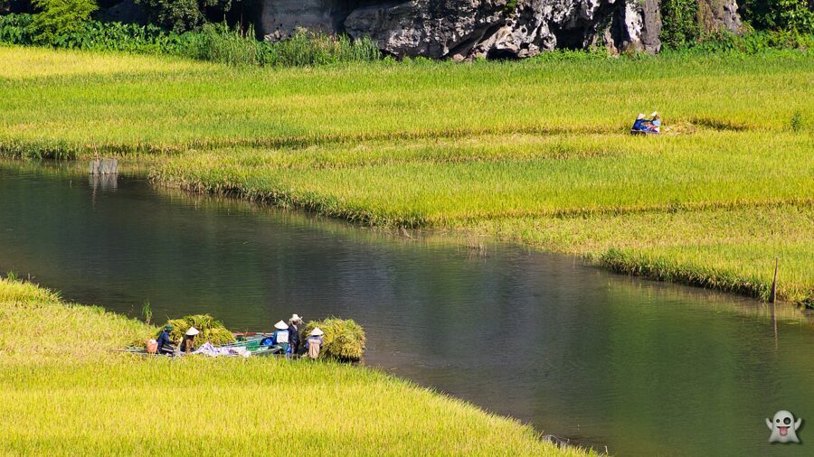

- Late May to early June: the rice at Tam Coc ripens and is cut. The best time for the Tam Coc boat and the Hang Mua view, and the busiest.
- June to August: hot and humid, with highs often in the mid-30s °C and sudden downpours. Go out early, rest at midday, and expect caves to flood after heavy rain.
- September to November: often the most comfortable weather, though storms can still stop the boats, as in September 2024 and on 9 November 2026.
- December to February: cool, misty and quiet on weekdays, with the karst at its moodiest. Tet brings closures on the main days, then huge crowds.
- The first three lunar months: festival season, roughly February to April, with Bai Dinh at its peak and the Trang An festival on the 17th to 19th of the third lunar month.
Whatever the month, avoid the national holidays. The 30 April and 1 May break and 2 September bring domestic visitors in their tens of thousands, and the wharf becomes a crowd with boats attached. Weekdays are always calmer.

Eating around Trang An
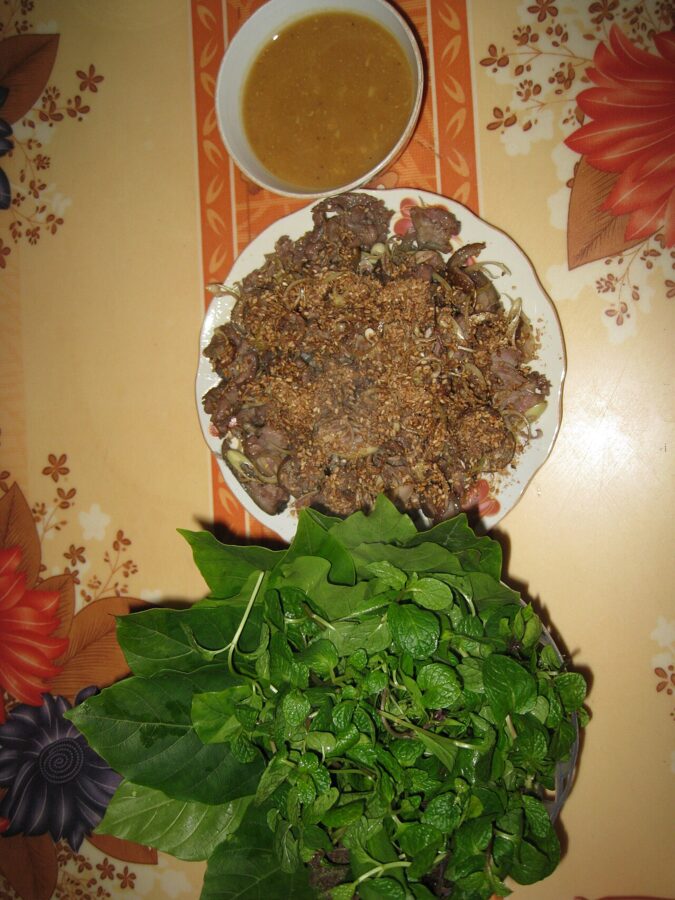
Ninh Binh’s best-known dish is mountain goat (dê núi), from goats raised on the limestone. It comes rare with lime (dê tái chanh), grilled (dê nướng) or stir-fried (dê xào lăn), at restaurants along the roads around Trang An, Hoa Lu and Tam Coc. Ask the price before you order.

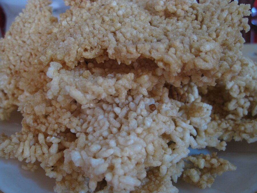
The other speciality is cơm cháy (crispy rice crust): the crust from the bottom of the rice pot, dried and fried into golden slabs, then served with a goat or pork sauce. Tam Coc town has the widest choice of places to eat; around the Trang An wharf it is mostly large restaurants for tour groups.


So go back to that first decision. Buy the ticket for route 1 or 3, be on the water when the wharf opens, and let the rower set the pace with her feet. By the time the day tours arrive from Hanoi, you should be ducking under your last cave roof.